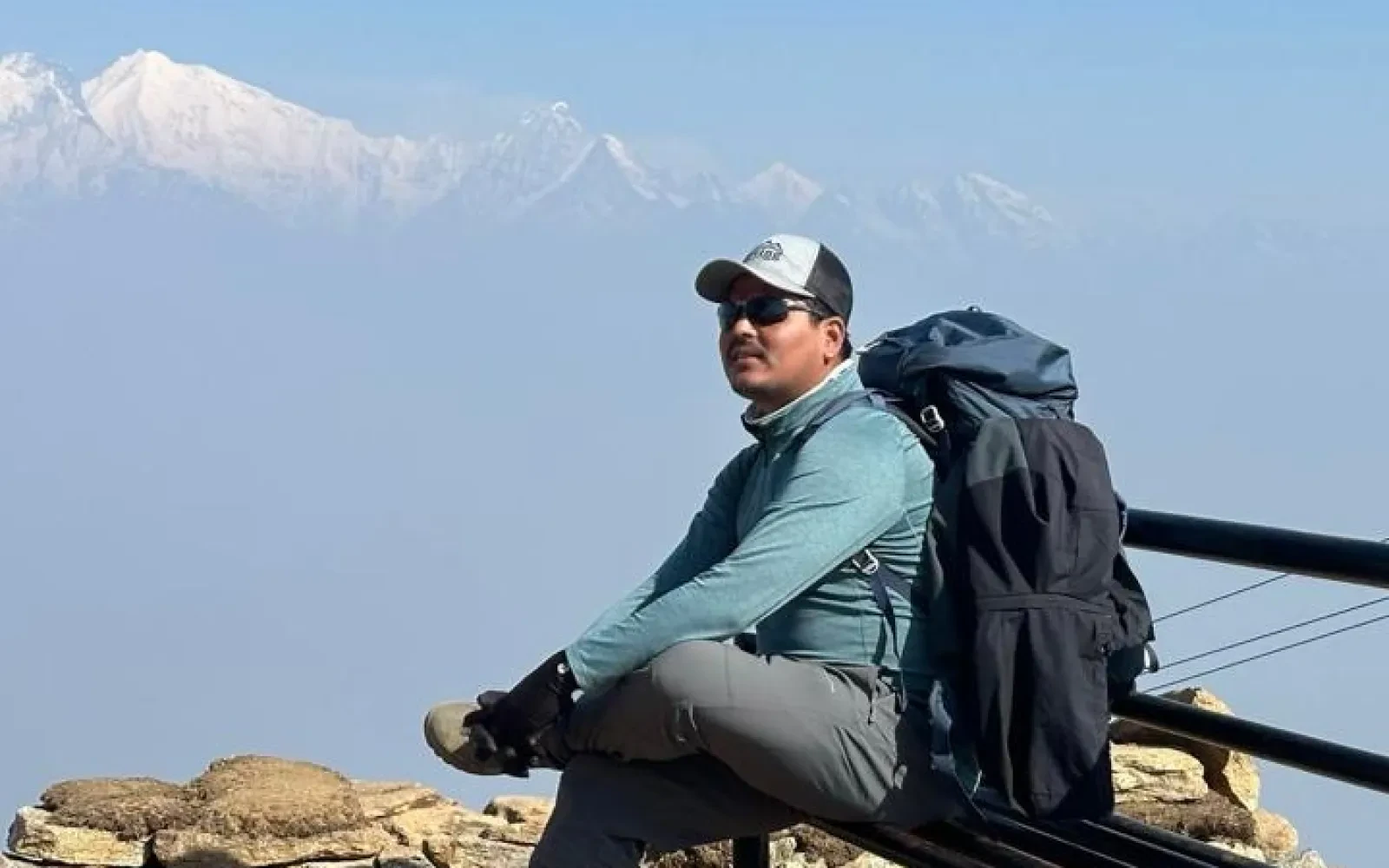
Let's find out about the Manaslu Circuit Trek Distance in today's blog. Lots of our clients are inquiring about this trek in these past two trekking seasons. People are shifting their attention to this amazing trekking trail inside the restricted areas of Nepal. Experience rawness, rural vibes, and Himalayan wilderness in the Manaslu Trek route that includes daring Larke La Pass crossing.
The Manaslu Circuit Trek distance covers a total trekking distance of approximately 177 km to 195 km round trip, depending on the starting and ending points chosen by the trekking agency or traveler. This distance makes it one of the longer trekking routes in Nepal compared to popular treks like Annapurna Base Camp or Everest Base Camp. The trek circles Mount Manaslu (8,163m), the eighth-highest mountain in the world, and passes through remote villages, deep river valleys, and high mountain passes. The variation in distance mainly comes from road accessibility changes, especially in the lower sections of the trail, and optional side hikes such as Birendra Lake or Manaslu Base Camp viewpoints. Overall, this trek is not only about distance but also about altitude gain, terrain variation, and remote wilderness experience.
Before the actual trekking begins, travelers must cover a significant road journey from Kathmandu to the trailhead. The distance from Kathmandu to Machha Khola is approximately 160 to 170 kilometers, usually taking around 7 to 9 hours by jeep or bus depending on road conditions. This drive is an adventurous part of the journey itself, as it passes through winding hilly roads, river valleys, and rural settlements of Nepal. Some itineraries may start from Soti Khola, which adds a bit more walking distance to the trek. Road conditions can vary depending on the season, especially during monsoon when landslides or muddy roads may slow down travel. This initial journey sets the tone for the remote and rugged nature of the Manaslu region.
The first trekking day from Machha Khola to Jagat covers approximately 22 kilometers, making it one of the longest walking days in terms of pure distance. The trail follows the Budhi Gandaki River, crossing several suspension bridges, small villages, and terraced farmlands. The path is a mix of uphill and downhill sections, with stone steps and narrow cliffside trails. Trekkers gradually gain elevation of around 600–700 meters during this section. Despite being relatively low altitude, the long walking hours of 7–8 hours make it physically demanding for beginners. This section introduces trekkers to the rural lifestyle of Nepal, where local Gurung and Magar communities live in traditional stone houses and rely heavily on agriculture and tourism.
The trek from Jagat to Deng covers approximately 19 to 20 kilometers, taking around 6 to 7 hours of walking. This section marks the official entry into the restricted Manaslu Conservation Area, where permits are strictly checked. The trail becomes more rugged, with dense forests, steep stone staircases, and narrow pathways carved into hillsides. Trekkers experience a noticeable change in landscape as the environment becomes more remote and less populated. The elevation gain is around 900–1,000 meters, making it a moderately challenging day. Small villages like Philim and Ekle Bhatti provide rest points along the route. This section is also known for its natural beauty, including waterfalls, river gorges, and occasional views of snow-capped peaks in the distance.
The Deng to Namrung section is approximately 19 kilometers, and it usually takes around 6 to 7 hours of trekking. The trail continues to ascend steadily through pine forests, suspension bridges, and small settlements influenced by Tibetan culture. As trekkers gain altitude of nearly 900 meters, the landscape starts changing dramatically, with more alpine vegetation and fewer green farmlands. Villages become more culturally Tibetan in architecture and lifestyle, with prayer flags, mani walls, and monasteries appearing along the route. This section is physically demanding due to continuous uphill climbs but is rewarding due to panoramic valley views and increasing mountain visibility. Namrung (2,630m) is a key acclimatization stop before entering higher altitude zones.
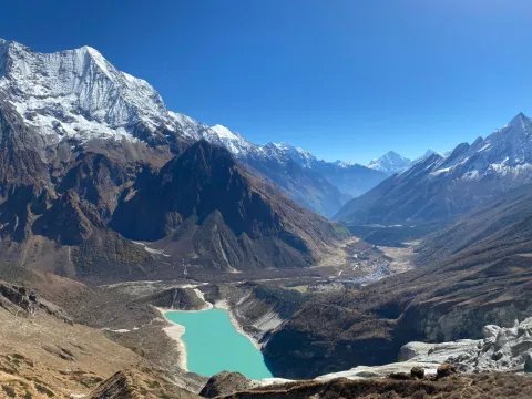
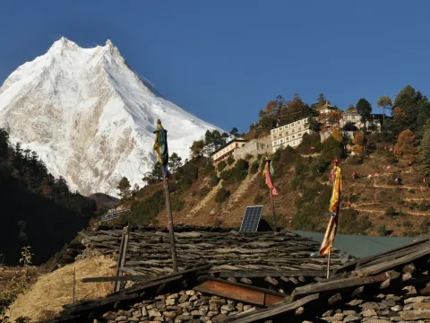
The distance from Namrung to Sama Gaun is approximately 17 kilometers, usually taking 6 to 7 hours. This section is one of the most scenic parts of the Manaslu Circuit Trek as trekkers begin to see close views of Mount Manaslu and surrounding peaks. The trail passes through villages like Lho and Shyala, which offer stunning Himalayan panoramas and ancient monasteries. The elevation gain is around 900 meters, reaching Sama Gaun at approximately 3,530 meters. This village is one of the largest settlements on the route and serves as a major acclimatization point. The terrain is a mix of forest paths and open alpine landscapes, offering breathtaking photography opportunities and cultural experiences.
Sama Gaun is a crucial acclimatization stop, and although it is a rest day, trekkers often undertake optional hikes covering 6 to 12 kilometers round trip. The most popular excursion is to Birendra Lake, a beautiful glacial lake located at the base of Manaslu. Another challenging option is the hike toward Manaslu Base Camp viewpoint, which provides stunning panoramic views of glaciers and the mountain itself. These hikes are not mandatory but are highly recommended for proper acclimatization before ascending higher. The terrain is steep and rocky, and altitude plays a major role in difficulty. This rest day significantly reduces the risk of altitude sickness and prepares the body for higher elevations ahead.
The trek from Sama Gaun to Samdo is relatively short, covering around 8 to 9 kilometers and taking 3 to 4 hours. Despite the short distance, this section is important for acclimatization as the altitude rises to around 3,860 meters. The trail is dry, windy, and influenced by Tibetan plateau geography, with fewer trees and more open landscapes. The path is relatively gentle compared to previous days but can feel tiring due to reduced oxygen levels. Samdo is a small Tibetan-influenced village close to the Nepal-Tibet border. This section helps trekkers adjust to higher altitude conditions before the challenging pass crossing ahead.
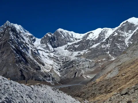
The distance from Samdo to Dharamsala (Larke Phedi) is approximately 6 to 7 kilometers, taking around 4 to 5 hours. Although short in distance, this is one of the most physically demanding days due to altitude, as Dharamsala sits at around 4,460 meters. The trail ascends gradually through barren landscapes with strong winds and cold temperatures. Vegetation becomes almost nonexistent, and trekkers feel the effects of thin air more strongly. Dharamsala is a basic resting point before crossing Larke La Pass the next day. Accommodation is very simple, and trekkers are advised to rest early and prepare for the long and challenging pass crossing.
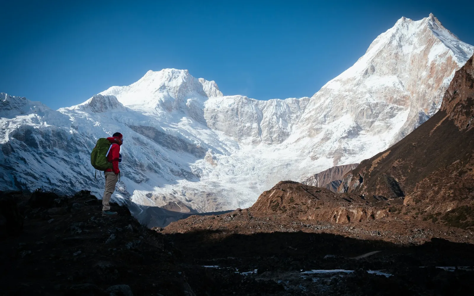
The most challenging and longest day of the trek is the crossing of Larke La Pass (5,106m). The total distance covered on this day is approximately 24 to 26 kilometers, including both ascent and descent. Trekkers start very early, often around 2–3 AM, to avoid strong winds and weather changes at the pass. The ascent is steep and slow, crossing glacial terrain before reaching the summit of the pass. After reaching the top, a long and steep descent follows toward Bimthang. This section requires 8–10 hours of continuous walking and is physically and mentally demanding. However, it also offers some of the most spectacular Himalayan views in Nepal.
From Bimthang to Dharapani, the trek covers approximately 18 to 20 kilometers, taking around 6 to 7 hours. This section is mainly downhill, passing through lush forests, rivers, and open valleys. The descent of nearly 1,500 meters can be tough on the knees, so careful walking is essential. This part of the trek marks a dramatic change in landscape as trekkers leave the high alpine region and enter greener, lower-altitude environments. Villages become more frequent, and the trail becomes easier compared to previous days. Dharapani connects the Manaslu Circuit with the Annapurna region, marking the official end of the trekking route.
The total Manaslu Circuit Trek distance ranges between 177 km and 195 km, depending on route variations, transport choices, and side trips. This includes all trekking days from Machha Khola to Dharapani. The distance may increase slightly if trekkers include additional acclimatization hikes or alternative trail sections. Compared to other Himalayan treks, this is considered a long-distance trekking journey that requires endurance and proper preparation. However, the trail is well-paced with gradual ascents and strategically placed villages, making the journey manageable for fit trekkers with basic trekking experience.
While the total distance of the Manaslu Circuit Trek is significant, the real challenge comes from elevation gain. The trek involves a cumulative ascent of approximately 9,000 to 10,000 meters, with the highest point being Larke La Pass at 5,106 meters. This combination of long distance and high altitude makes the trek physically demanding. Even shorter walking days can feel exhausting due to reduced oxygen levels above 3,500 meters. Proper acclimatization, slow pacing, hydration, and rest are essential for completing the trek safely. Understanding both distance and elevation is key to preparing effectively for this Himalayan adventure.
The Manaslu Circuit Trek is not recommended for absolute beginners due to its long distance, remote terrain, and high-altitude challenges. However, physically fit beginners with prior hiking experience can complete it successfully with proper preparation. Daily walking hours of 6–10 hours, combined with nearly 180+ kilometers of total distance, require endurance and mental strength. Training before the trek, including cardio exercises and hiking practice, is highly recommended. With the support of experienced guides and a well-planned itinerary, the trek becomes manageable and highly rewarding, offering one of the most authentic Himalayan experiences in Nepal.
What do you know about traveling to the most remote areas of Nepal? It requires money and manpower both for a successful and safe journey. Therefore, today’s blog is about the Manaslu Circuit Trek Cost Guide. Get the latest information about various expenses that you must do while doing the famous 12 Days Manaslu Circuit Trek in Nepal.
The Manaslu Circuit Trek is one of Nepal's most spectacular trekking experiences, offering remote mountain landscapes, authentic Himalayan villages, and the challenging crossing of Larkya La Pass at 5,106 meters. Proper preparation is crucial for a successful trek, and having the right packing list can make a significant difference in your comfort and safety.
The Manaslu Circuit Trek is one of Nepal's most rewarding and less crowded trekking adventures, offering an authentic Himalayan experience away from the busy trails of the Everest and Annapurna regions. Encircling the world's eighth-highest mountain, Mount Manaslu (8,163m), this spectacular journey takes trekkers through remote mountain villages, dense forests, deep river gorges, Buddhist monasteries, and high alpine landscapes.