The trekking landscape of Nepal has changed a lot over the years. After the county was opened to foreign mountaineering expeditions in 1949, climbers from around the world flocked to Nepal, hoping to be the first to summit Himalayan giants. Those first mountaineers were true trailblazers, finding their way to these mountains through relatively untouched, unforgiving terrain.
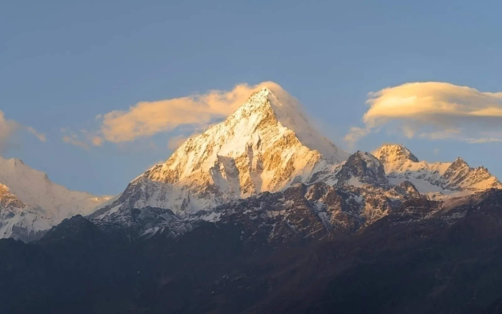
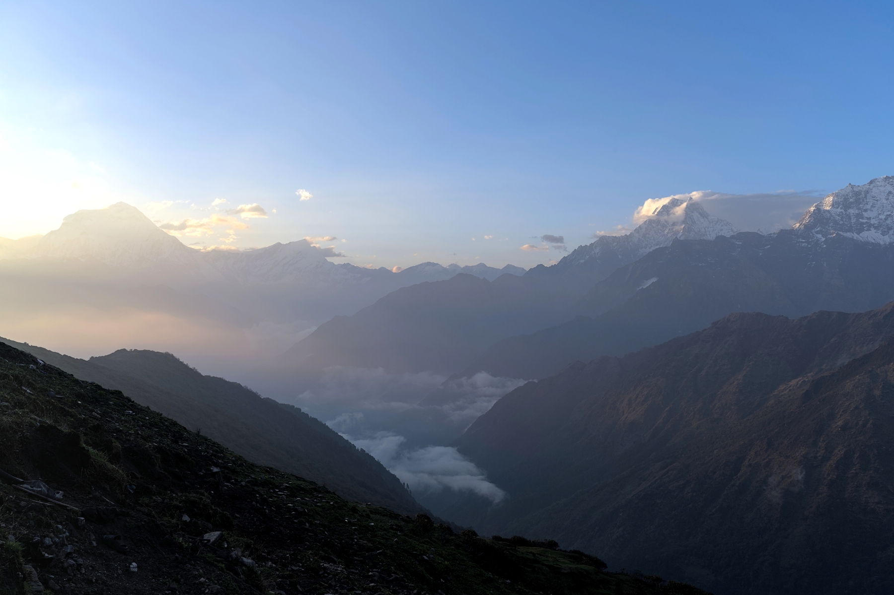
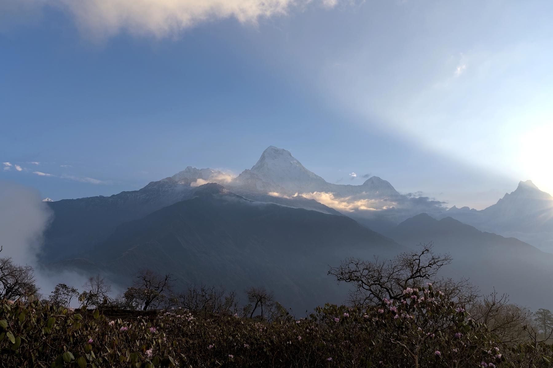
Sunset view of Annnapurna I (8,091 m) on left and Annapurna South (7,219 m) on right from Khopra
When they returned to their home countries, they brought back with them stories of the unparalleled beauty of the mountains they saw. And slowly, but steadily, people began to travel to Nepal not to climb mountains, but to see them with their own eyes. The trekking industry wasn’t much of an industry at first; accommodation was mostly tents and sleeping bags, navigation was done by maps and word of mouth, and everything needed for the trek had to be carried by the trekkers themselves. But some saw a business opportunity, and by the 1970’s, trekking agencies began to open their doors. Soon after, locals who lived along the trekking route opened their homes to trekkers in need of food and drink, and the first teahouses were born.
Fast-forward nearly 50 years and the Nepali trekking industry has grown exponentially; now a half-billion dollar a year industry. Walk through Thamel in Kathmandu and you’re never more than a stone’s throw from the office of a trekking agency, and if you look in any direction, you’ll see multiple stores selling trekking gear. And it isn’t just Kathmandu that has changed because of trekkers. The route to Everest Base Camp, which was once a wild, uncharted path where people slept in tents for the night, now has well-maintained trails and hundreds of tea houses along the way offering hot showers, high speed internet, and pizza. 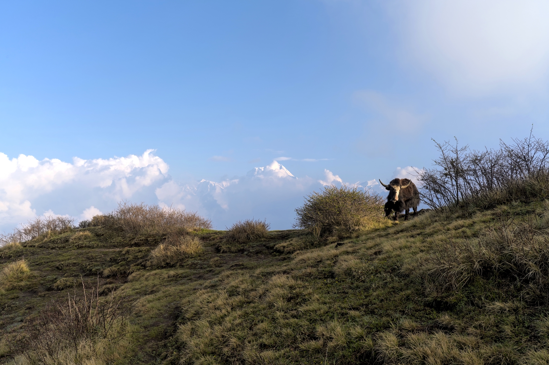
View of Dhauligiri just after sunrise from Mulde Viewpoint. There were many yaks grazing there that morning
In other words, although trekking has been a boon to the local economy, along many famous and well-established treks the sense of nature and adventure have disappeared. If you trek to Ghorepani and climb Poon Hill for sunrise, you will be sharing that hilltop with hundreds of people taking selfies, recording Tik Tok videos, and waiting in line at the coffee shop (yes, they have a coffee shop), which takes away the sense of nature. If you trek the Annapurna Circuit there will be long sections where the former trail has been repurposed into a road complete with with jeeps, trucks, and heavy machinery, which takes away the sense of adventure. And you will be sharing the trail to Everest Base Camp with thousands of people, which takes away the peace and quiet that people often seek in a trek.
It's understandable why these famous, well-established treks are so crowded and commercialized; the views that they offer are incredible. But many hikers want to see mountain views in a more natural setting, and of these people, few of them like the idea of camping in the backcountry for days on end in other “off the beaten path treks” like the Upper/Lower Dolpo Treks, the Dhaulagiri Circuit, and the Makalu Circuit. What these people are looking for is the “Goldilocks zone” of trekking: established trekking infrastructure and smaller crowds, while still boasting views that rival the well-known treks.
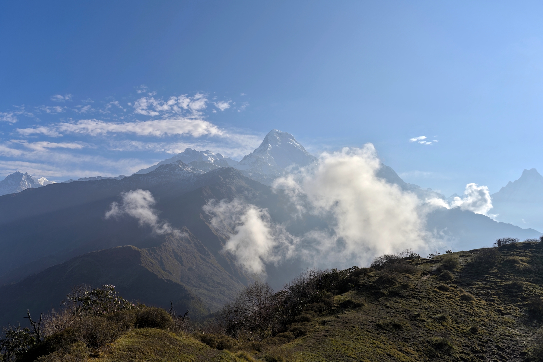
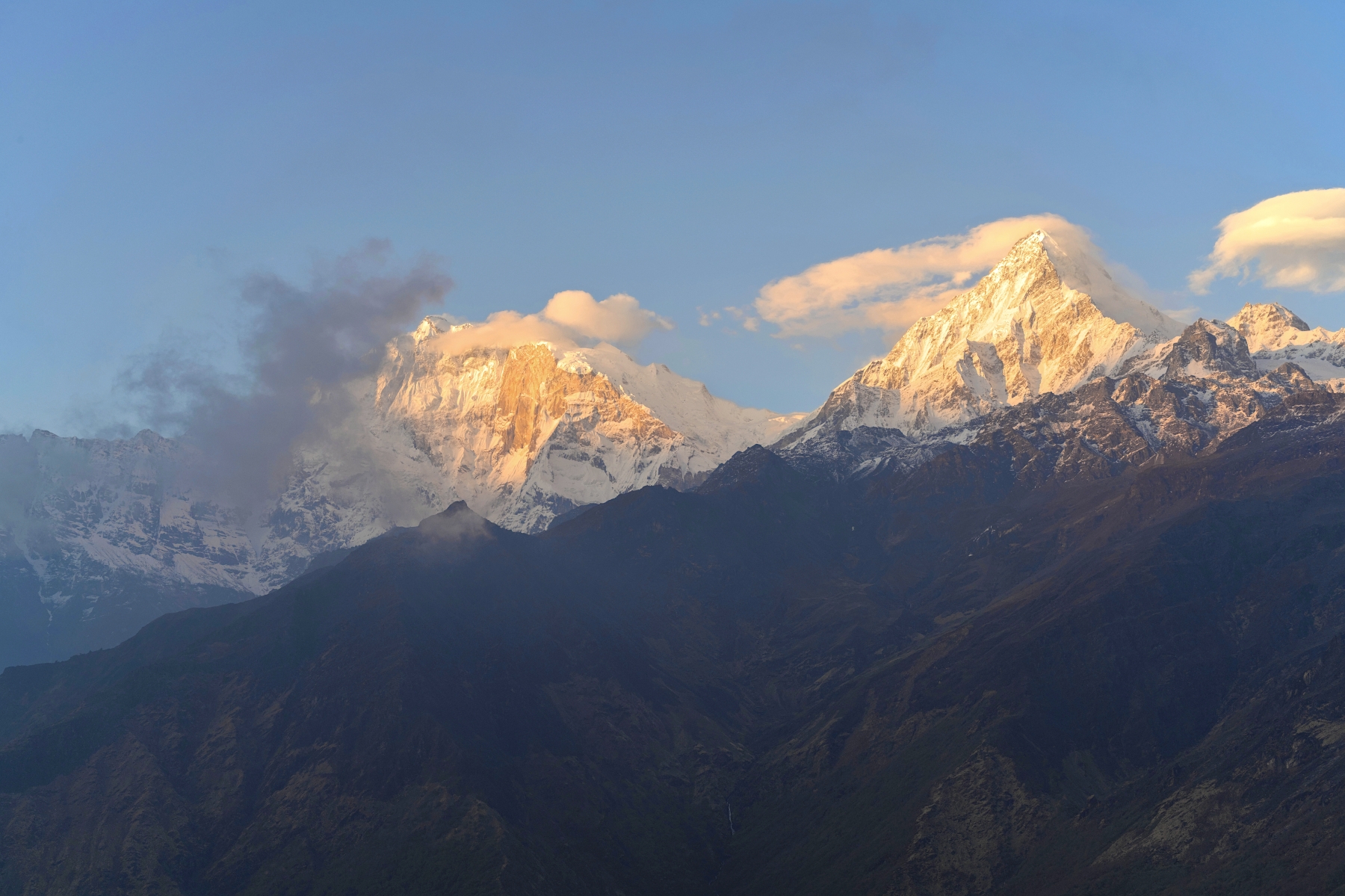
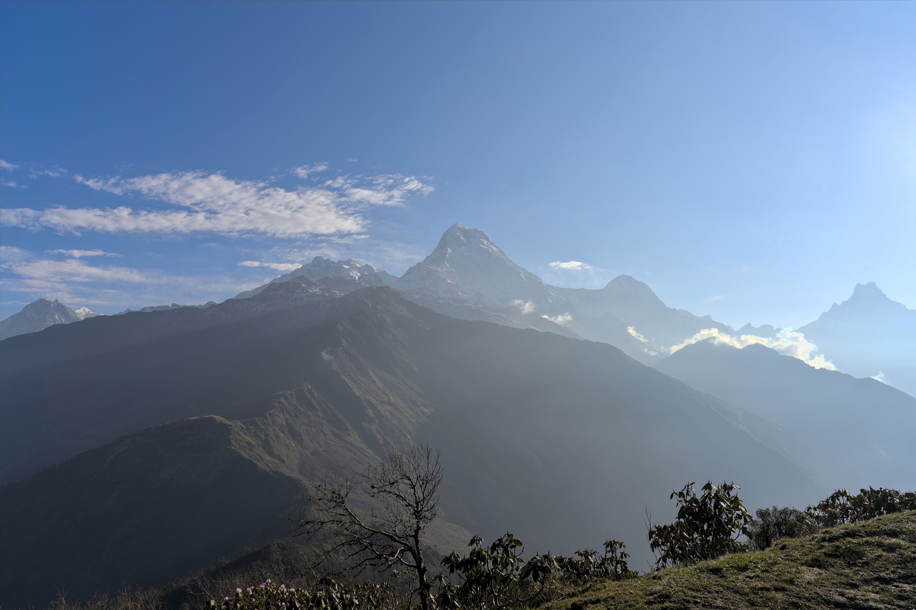
Morning view from Mulde. Nilgiri (left), Machhapuchare (right) and Annapurna I, South, and Hiunchuli (center)
Thankfully, there are still treks in Nepal that fall within this “Goldilocks zone.” And the photos you have seen so far in this blog are from that trek. It is called the Khopra Danda Trek, and although it sees a fraction of the trekkers that go to Poon Hill, Annapurna Base Camp, or Annapurna Circuit, it boasts views that rival (and possibly even surpass) these legendary treks. Did you like the views seen in the photos so far in this blog post? They can all be found on the Khopra Danda Trek!
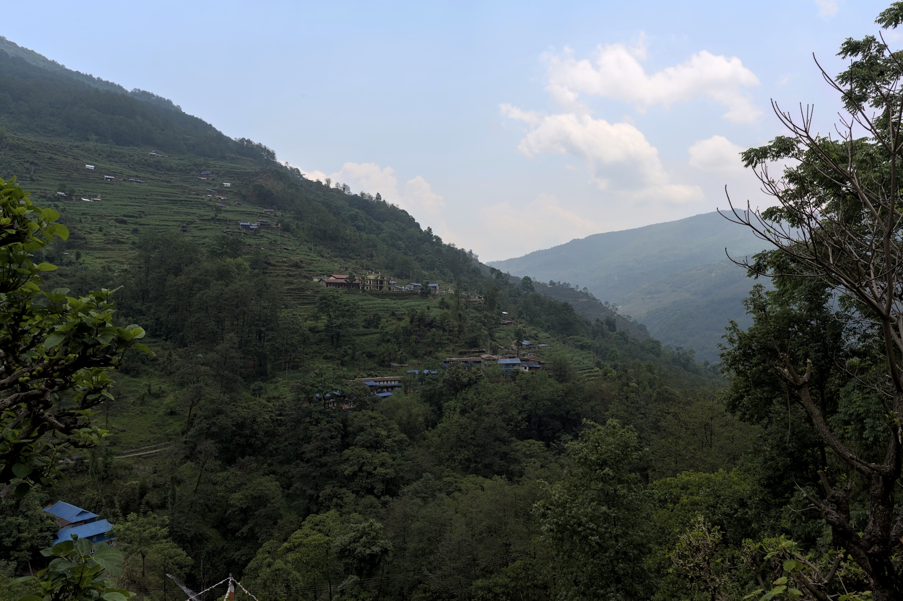
The Khopra Danda Trek is a relatively new trek in the Annapurna Region. The trek takes place on the southern side of the Annapurna Massif, in the same general area as the well-known Poon Hill, Annapurna Base Camp, and Mardi Himal Treks. Poon Hill and Annapurna Base Camp are probably the two most popular treks in Nepal, and as a result, they are always crowded in season. Mardi Himal was once an “off the beaten path” trek, but due to its relatively short length, high altitude environment, and great views of the Annapurna Range (and especially Machhapuchhare), it is now an extremely popular and increasingly crowded trek. But the Khopra Danda Trek has not yet reached these levels of popularity and remains a bit of a hidden gem.
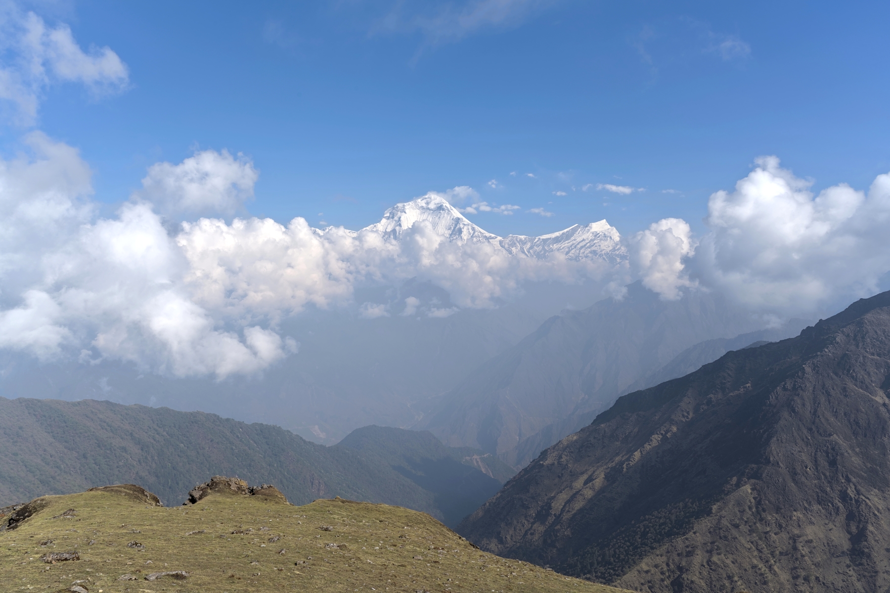
View of Khopra Ridge (bottom left) from the Khayer Lake trail. Dhaualgiri (8,067 m) is the large mountain in the center
The Khopra Danda Trek goes by a few names: Khopra Danda, Khopra Hill, and Khopra Ridge to name a few. But rest assured, they are all the same trek. The word for “hill” in Nepali is “Danda,” so saying Khopra Danda and Khopra Hill is saying the same thing, just in two different languages. The settlement of Khopra is actually on a narrow mountain ridge rather than a hill, which is why it is sometimes called the Khopra Ridge Trek. Whatever you call it, the Khopra Danda Trek is one of the best kept secrets in Nepal trekking. Keep reading to find out why.
The Khopra Danda Trek, despite being in the heart of the Annapurna Region, sees shockingly few trekkers each year. When I did this trek in mid-May 2025, which is peak trekking season in Nepal, I only saw one trekker on the trail during from Dobato to Khopra, which is typically three days-worth of trekking. She was doing the trek at the same time as me, and like me, decided to compress this section of the trek into two days (more on that later). That’s how unknown this trek is currently!
Dhaulagiri from Mulde Viewpoint. The woman on the swing was the only other person there for sunrise that morning
The hike from Khopra to Khayer Lake and back was slightly more crowded, in that I saw a total of 7 other people on the trekking trail throughout the 8-hour hike. For such an incredible hike and such a beautiful lake at the end of it, being able to count all the hikers I saw that day on two hands is insane. At Khopra the teahouse was full, so it certainly felt more crowded than the previous couple of days. But by “the teahouse” I was referring the only teahouse there is in Khopra. You see, this is a community-based trek and the revenue made by the teahouse on the Khopra Ridge goes to funding schools in the local community (by local I mean farther down the mountain). If you needed another reason to do this trek, trekking here helps the local communities even more than most other treks! As of May 2025, they were building what looked like another teahouse or a large extension to cope with the crowds, which I can tell you are going to continue to increase a ton in the years to come.
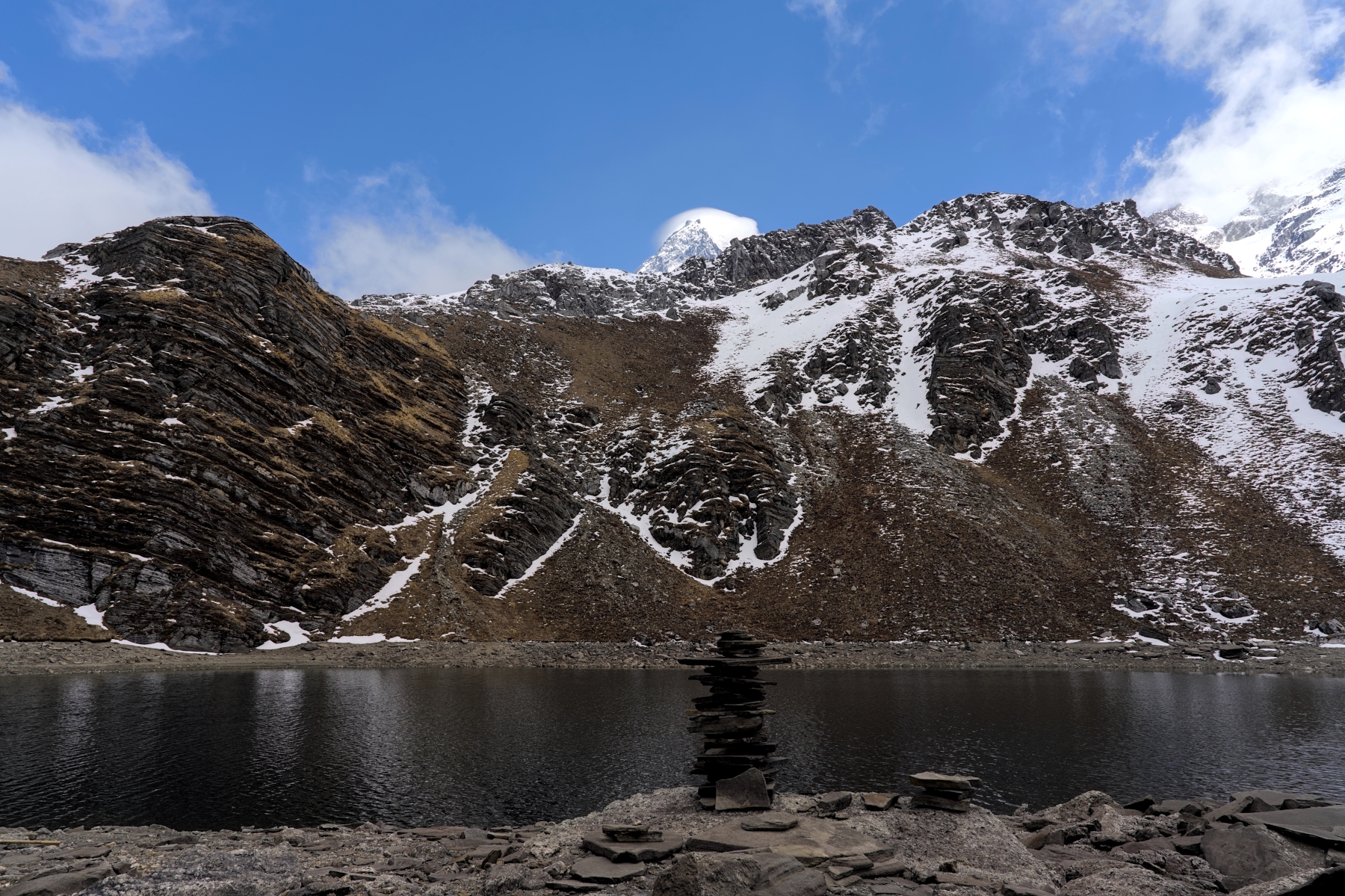
Khayer Lake in early afternoon. Cairn stones show people come here, but not a soul seen for two hours before arriving
I saw at most 10 other trekkers on the hike down to Swanta, so that trail was nearly deserted as well. I can’t comment on the trail from Swanta to Tatopani because I instead opted to hike to Ghorepani to see Poon Hill again (yes, there is a trek that combines Khopra Danda and Poon Hill), but I don’t recall seeing any trekkers on that trail until I got within a kilometer or so of Ghorepani. When I tell you that such small crowds, during peak season in the Annapurna Region are unheard of, I mean it. If you’re looking for an Annapurna Region trek without the Annapurna Region crowds, this is the perfect trek.
The Khopra Danda Trek, though a relatively new trek, has some quality trekking trails. The trails are the best of both worlds: established enough where they are safe and easy to follow, but new enough where they still have a natural feel. The trail throughout most of the trek is clear and well-marked, consisting of hardpack dirt with sections of loose gravel and rocks. It is thoughtfully arranged, following natural ridges and valleys through the surrounding terrain, striking a balance between a direct route that cuts through the environment efficiently and a natural path that co-exists with and forms a part of the environment.
 View of the trekking trail from a teahouse in Isharu village
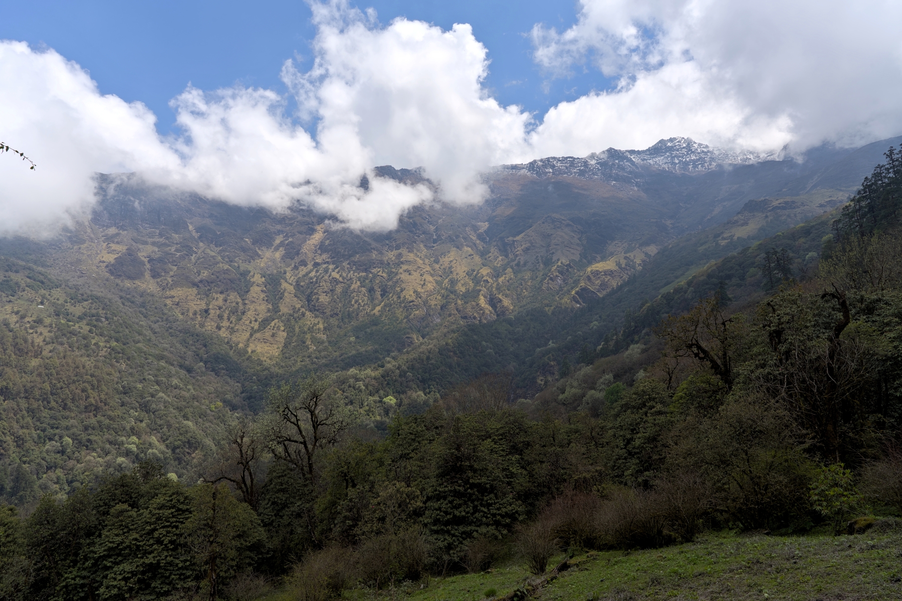
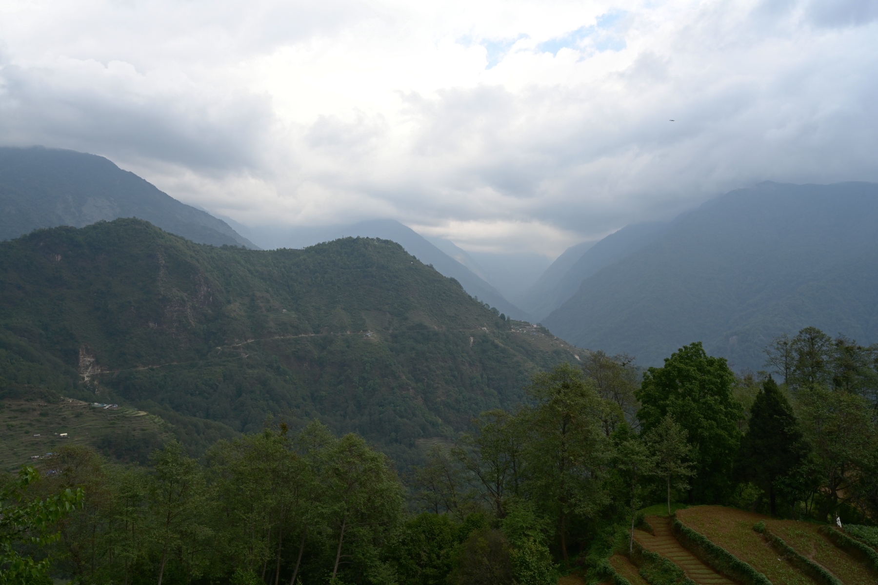
There is wide variety in the types of trails found on this trek. The trail from Ghandruk to Tadapani is mostly hardpack dirt with a few stone staircases, rising gradually through dense rhododendron forests. Although mountain views are few and far between in this section, these forests are beautiful in their own right; brimming with flora and fauna. As the trail nears Tadapani the forest opens up a bit, offering views of the Annapurna Range and Machhapuchhare periodically. Once in Tadapani, these mountains will be clearly visible in the distance, blocked only by afternoon clouds.
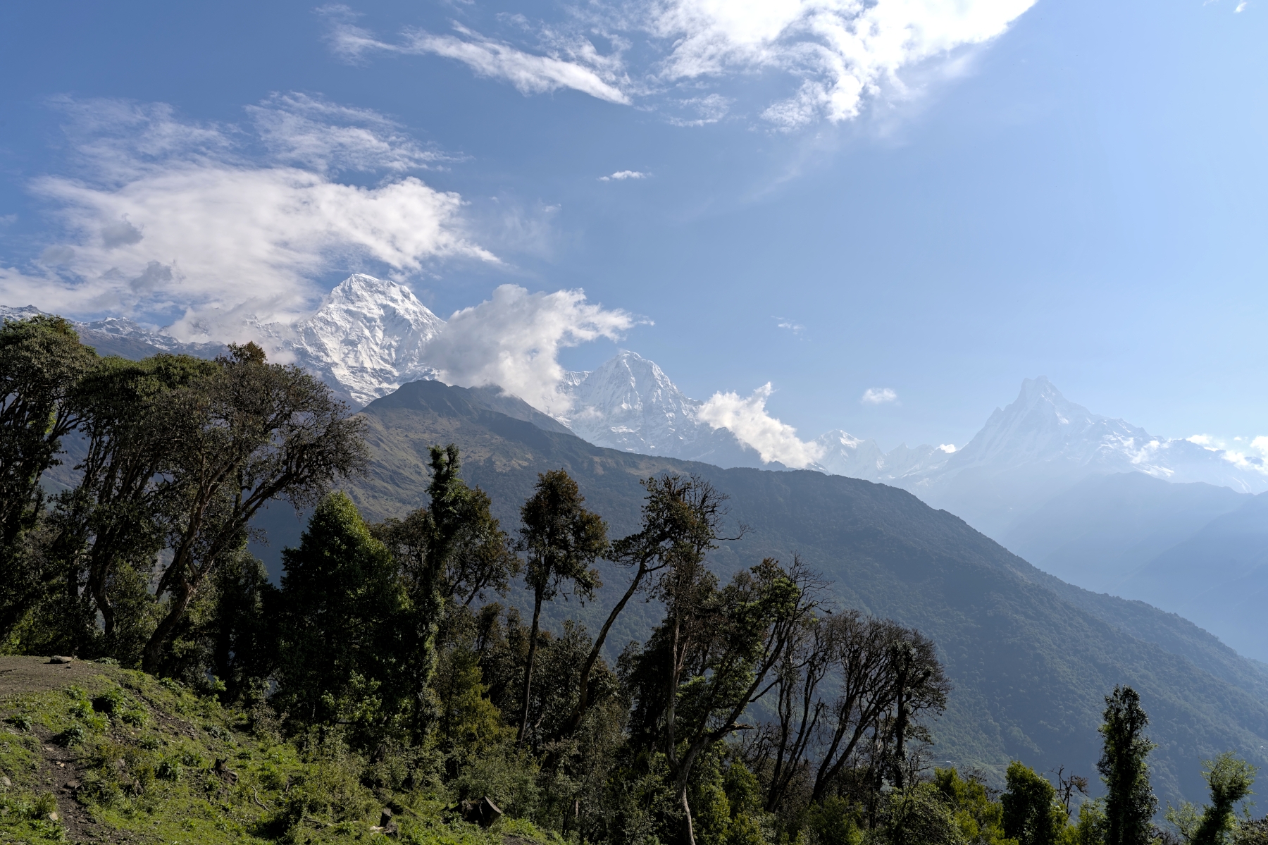
View of the Annapurna Massif (left), Hiunchuli (center), and Machhapuchhare 15 minutes outside Tadapani
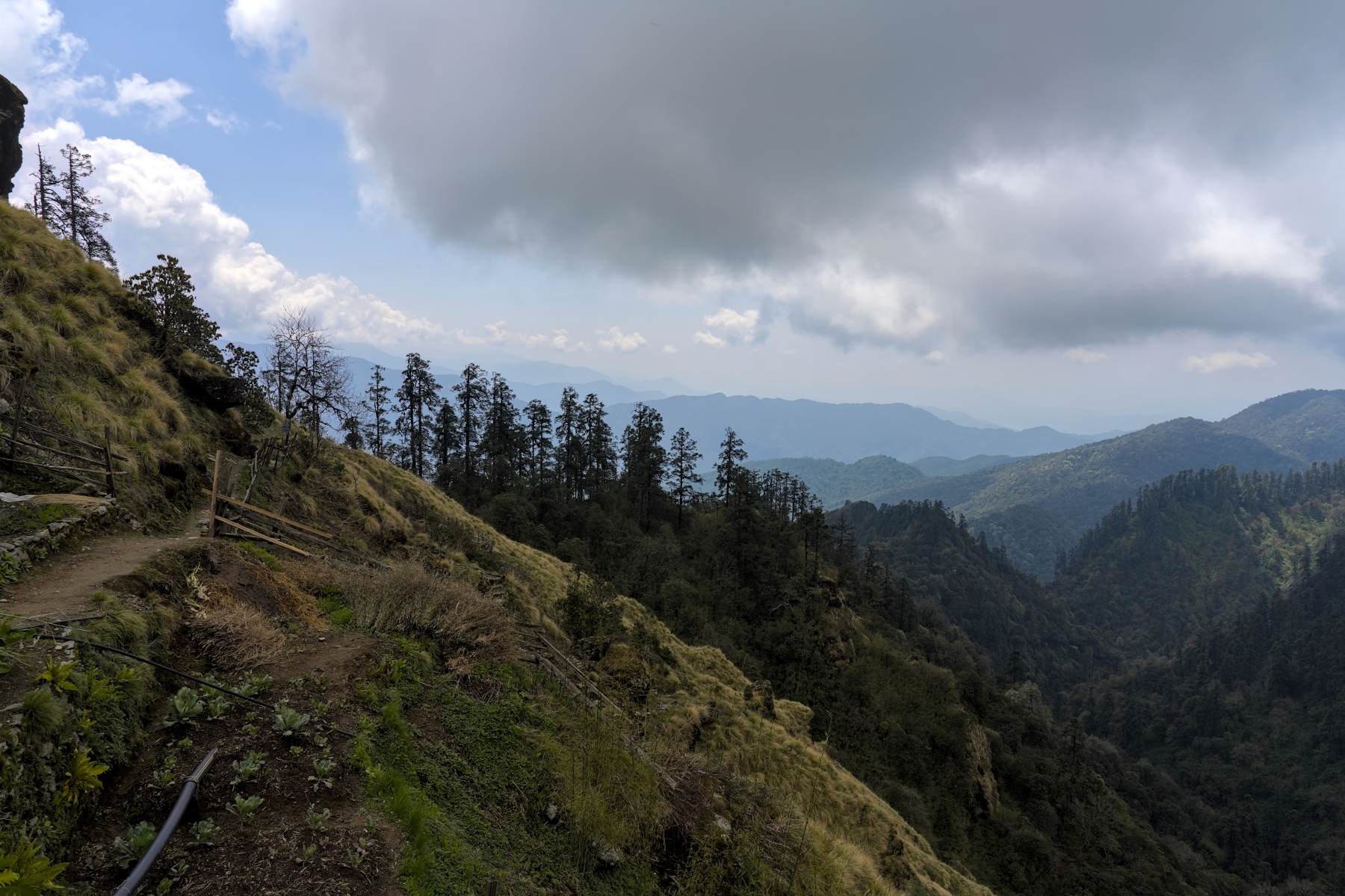
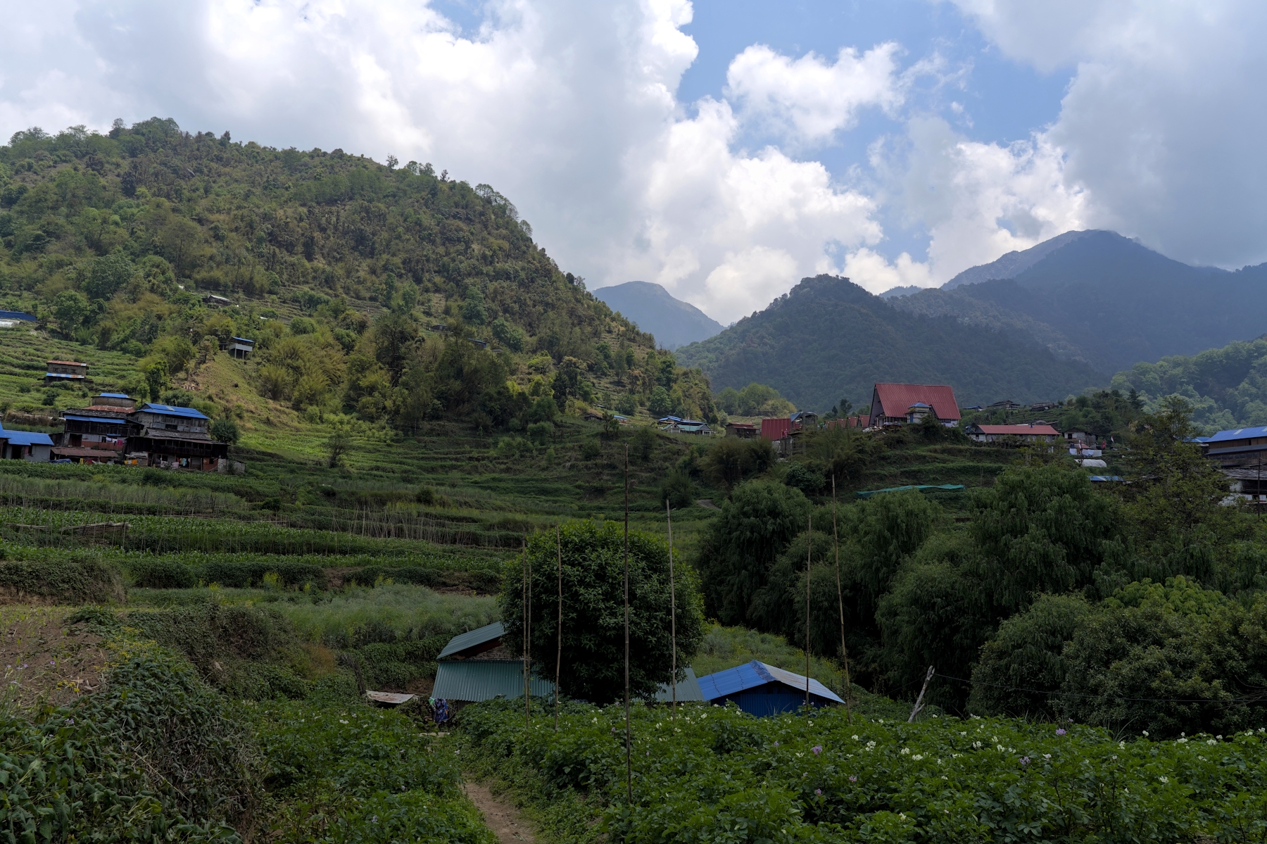
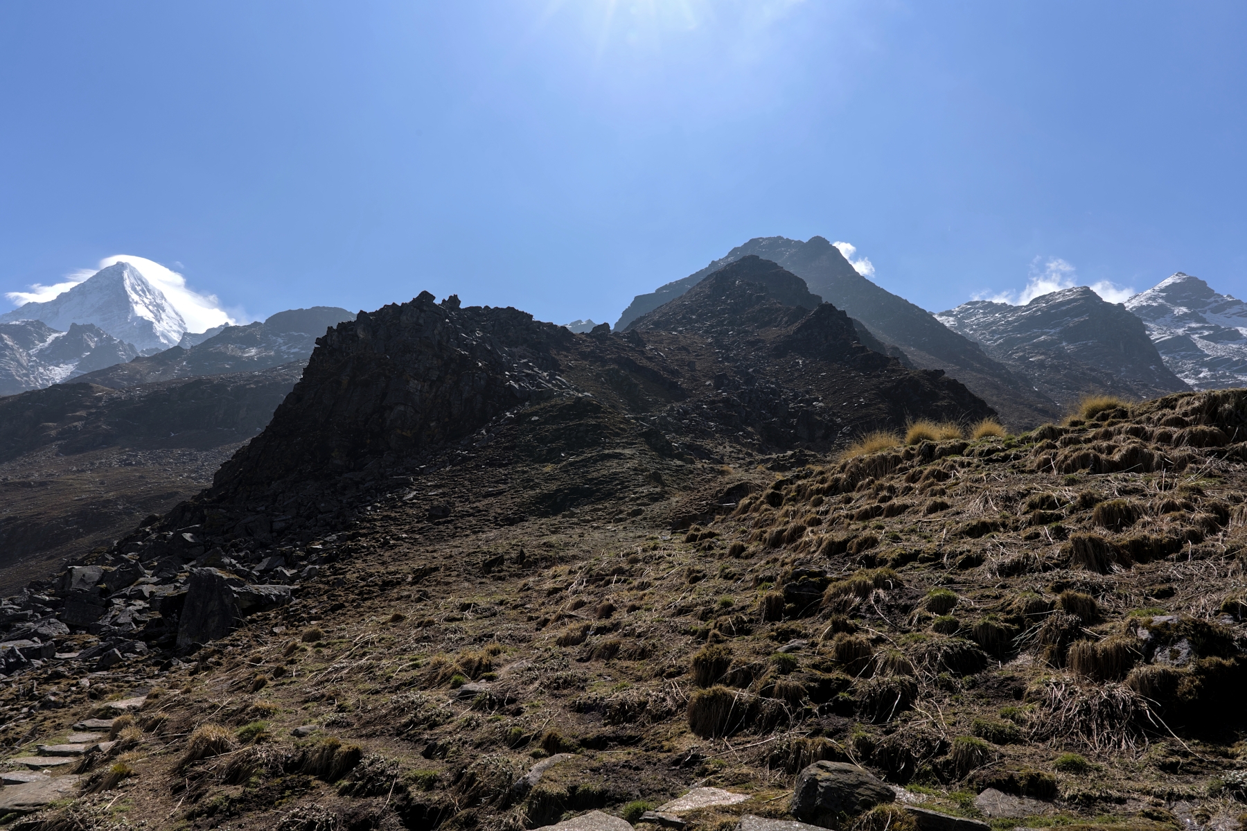
The trail from Tadapani to Dobato starts along the side of the hill, an easy, hardpack dirt covered trail with plenty of clearings where the beautiful mountain views can be seen. After a half hour or so the trail enters the forest, winding its way up switchbacks and hillsides, encountering meadows filled with wildflowers and bubbling streams along the way. The trail gains a lot of elevation in this section, but the gain is fairly gradual and the terrain doesn’t undulate much. After lunch in the lovely village of Isharu, the trail continues through the forest for a bit before once again hugging the hillside, with the Annapurna Massif and Machhapuchhare reappearing. The trail on this day weaves through nature effortlessly, and though 800 meters worth of elevation will be gained, the hike isn’t difficult at all.
View of the western part of the Annapurna Massif from Dobato, in late afternoon
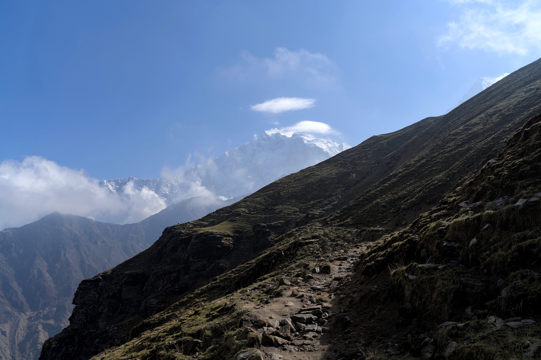
The trail to Mulde Viewpoint is steep and a bit raw in places, but unless it rained recently it should be easy going. Walking around on top of Mulde Hill is a breeze; although there aren’t marked paths the hilltop is mostly flat and completely above the tree line. In other words, walking from point to point is as simple as walking a straight line, turning only to follow a small ridge or gully. After leaving Dobato the trail again follows the hillside, except today there will be less foliage along the trail so the beautiful views of Annapurna and Machhapuchhare will be far more frequent. This section of the trail takes about an hour to walk, and is quite flat by Nepal standards.
After about an hour the trail will turn to the left and begin heading down the hill, through dense forests. The elevation loss here will be rapid, losing 500-600 meters of elevation in around two hours. The trail is mostly hardpack dirt with some sections having lose gravel and rocks, and there are numerous small waterfalls along the way which can make the trail a bit slippery. Eventually the trail reaches the river before starting back uphill towards Sistabung. This section consists of steep dirt switchbacks through dense forests, and by the time you reach Sistabung you will likely be quite tired.
The trekking trail between Dobato and Sistabung. The Khopra Ridge can be seen towering above
After Sistabung the trail gains elevation rapidly, and is at times quite steep. During the first half of this hike, the trail carves its way through forests, with the occasional clearing providing views of the valley to the west. In the second half of this hike the trail becomes even steeper and the trees disappear entirely, granting unimpeded views of the surrounding area. The trail in this section can be raw and rugged, with gravel-covered hardpack, some rocky sections, and way too many switchbacks. Eventually the trail flattens out a bit and for the last 15 minutes or so the trail hugs the side of Khopra Ridge, during which time Dhaulagiri can be seen in front.
The trekking trail just below Khopra. Dobato is on the right side of this photo, a little bit out of frame
And if you decide to trek to Khayer Lake as a part of this trek, the trail in that section is sublime. In all honesty, it is easily one of the best day hikes I’ve had, not just in Nepal but around the world. The trail to Khayer Lake ranges from hardpack dirt through yak pastures, to undulating rocky ridges, to alpine valleys surrounded by mountain peaks, to steep rock and boulder fields. More about the Khayer Lake hike can be found later in this blog, but suffice to say, if you can physically handle it, the trail to Khayer Lake is the best hike on the entire trek, and one of the best days of hiking you can have in Nepal. 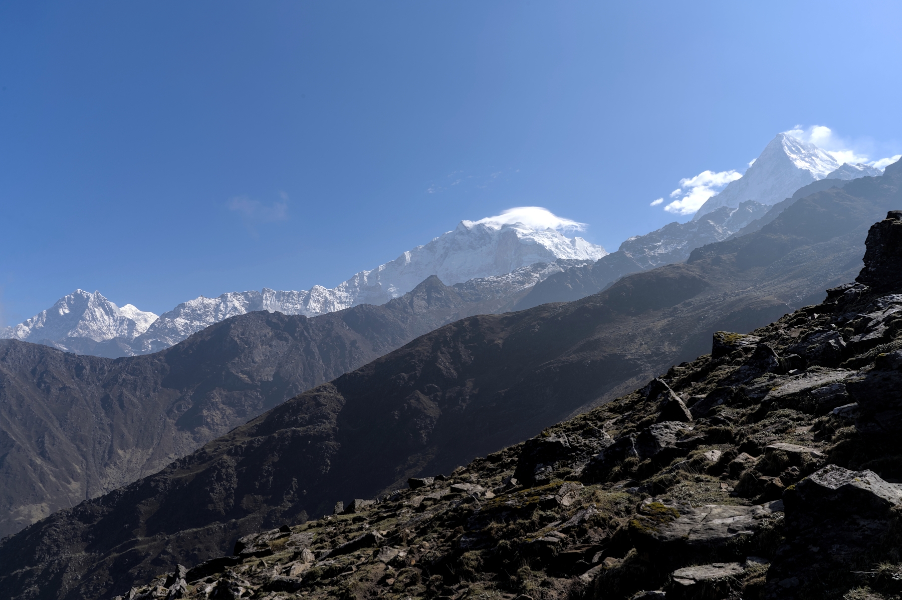
Trekking trail along the Khopra Ridge, on the way to Khayer Lake. Khopra is below and to the left, out of frame
Overall, the trekking route is relatively easy as far as treks in Nepal go. Except for the climb from Sistabung to Khopra and the optional Khayer Lake hike, the elevation gain is quite gradual and the trail undulates less than most. The trail is more wild and natural feeling than treks like Poon Hill, but it is still well-established and steady underfoot. And although altitude sickness is still a concern, with a maximum altitude of 3,660 meters, the risks of altitude sickness are less on this trek than other treks like the Annapurna Circuit or EBC Trek. That said, attempting the Khayer Lake hike raises the difficulty of the trek and the risk of altitude sickness considerably, so bear that in mind before deciding to undertake that hike.
Admittedly, on the Khopra Danda Trek, the teahouses aren’t as luxurious and the infrastructure is less developed as you’d find on the more popular hikes. Unlike the teahouses with amenities that rival hotels you’ll find in trekking locations like Ghorepani, Manang, and Namche Bazar, the teahouses on this route are pretty basic; comparable to what you might find in the upper reaches of the EBC Trek. Walls are typically thin plywood, beds are relatively small and stiff, and the overall temperature is a bit on the cold side. Hot showers aren’t always available, and where available, cost money. Cellular service isn’t reliable in many places along this route, and in general the Wi-Fi is not free. 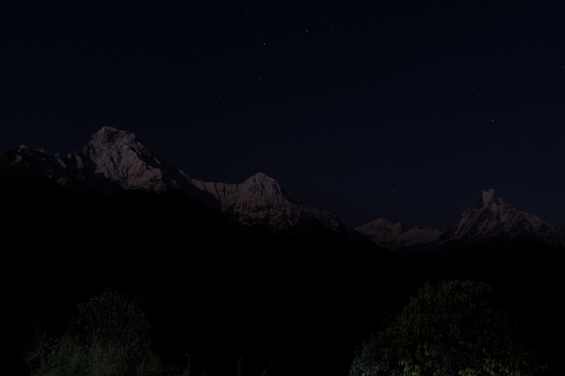
Night views of Annapurna (left), Hiunchuli (center), and Machhapuchhare (right) from teahouse rooftop in Tadapani
That said, the accommodation along the route is enough to get a good night’s sleep and feel rested for the next day’s hike. The teahouses typically have a nice fire going in the evening in the common room, so by sitting near it you can feel plenty warm (and have some great conversations while you’re at it). The food is also just as good as you’ll find on most treks, and considering how close the trek is to major roads, most items will be available and safe to eat, including meat. The basic accommodation and infrastructure make you feel close to nature, while still being able to connect to the modern world if needed.
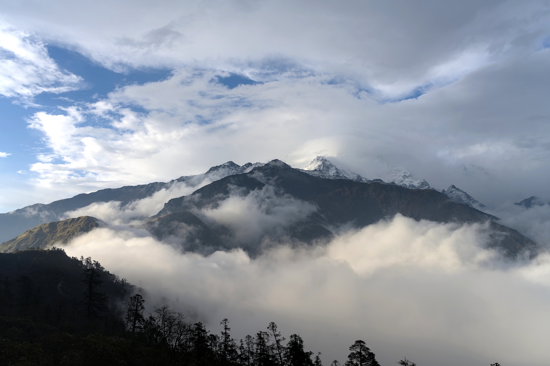
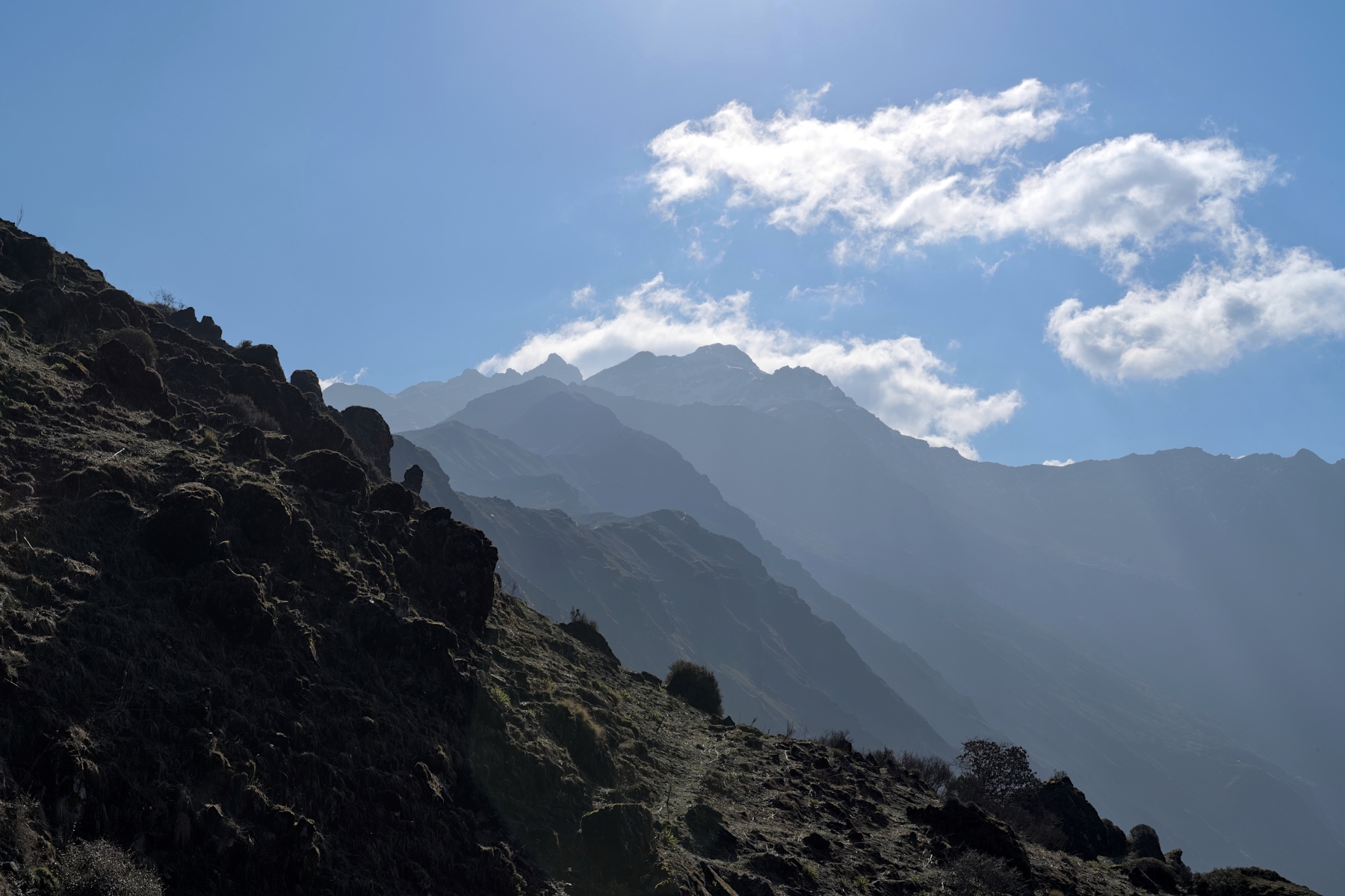
If you think that because this trek isn’t as popular as other treks in the Annapurna Region that the views must not be as good, you’d be wrong. The views from this trek are just as good as those found on more popular treks in the region, if not better. On this trek, you will see the same iconic views that can be seen from Poon Hill, except from much closer, from more angles, and without so many people. As the trail heads west after Dobato, Dhaulagiri and Tukuche can be seen in the distance, while the Annapurna Range looms above you. 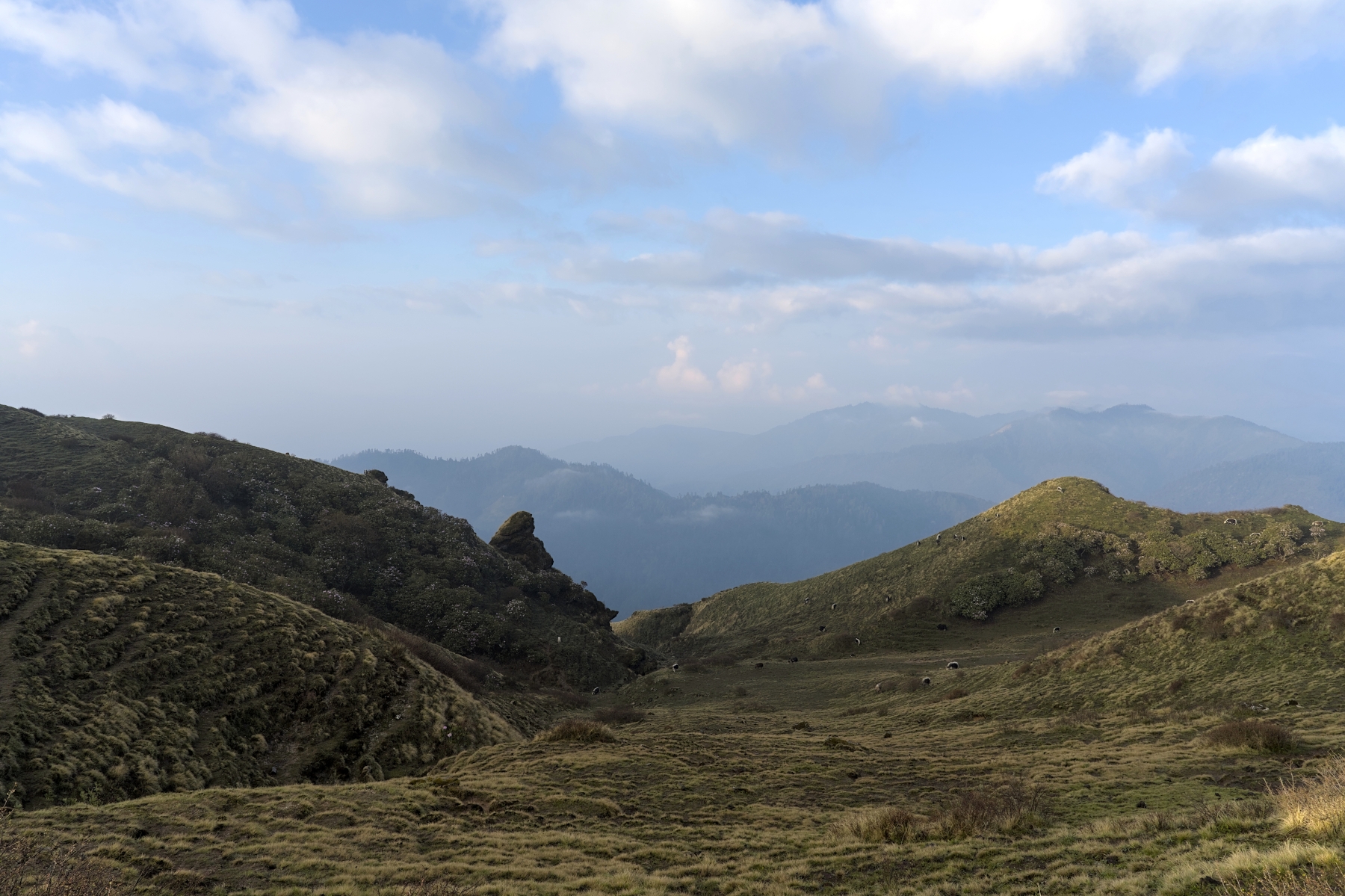
Mulde Viewpoint facing southwest. Unlike Poon Hill, the views are stunning in all directions
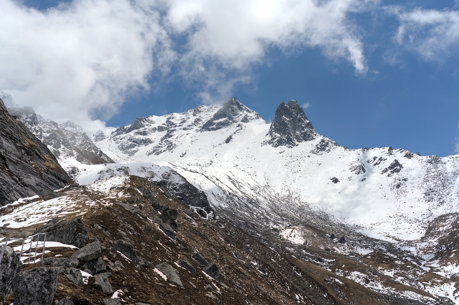
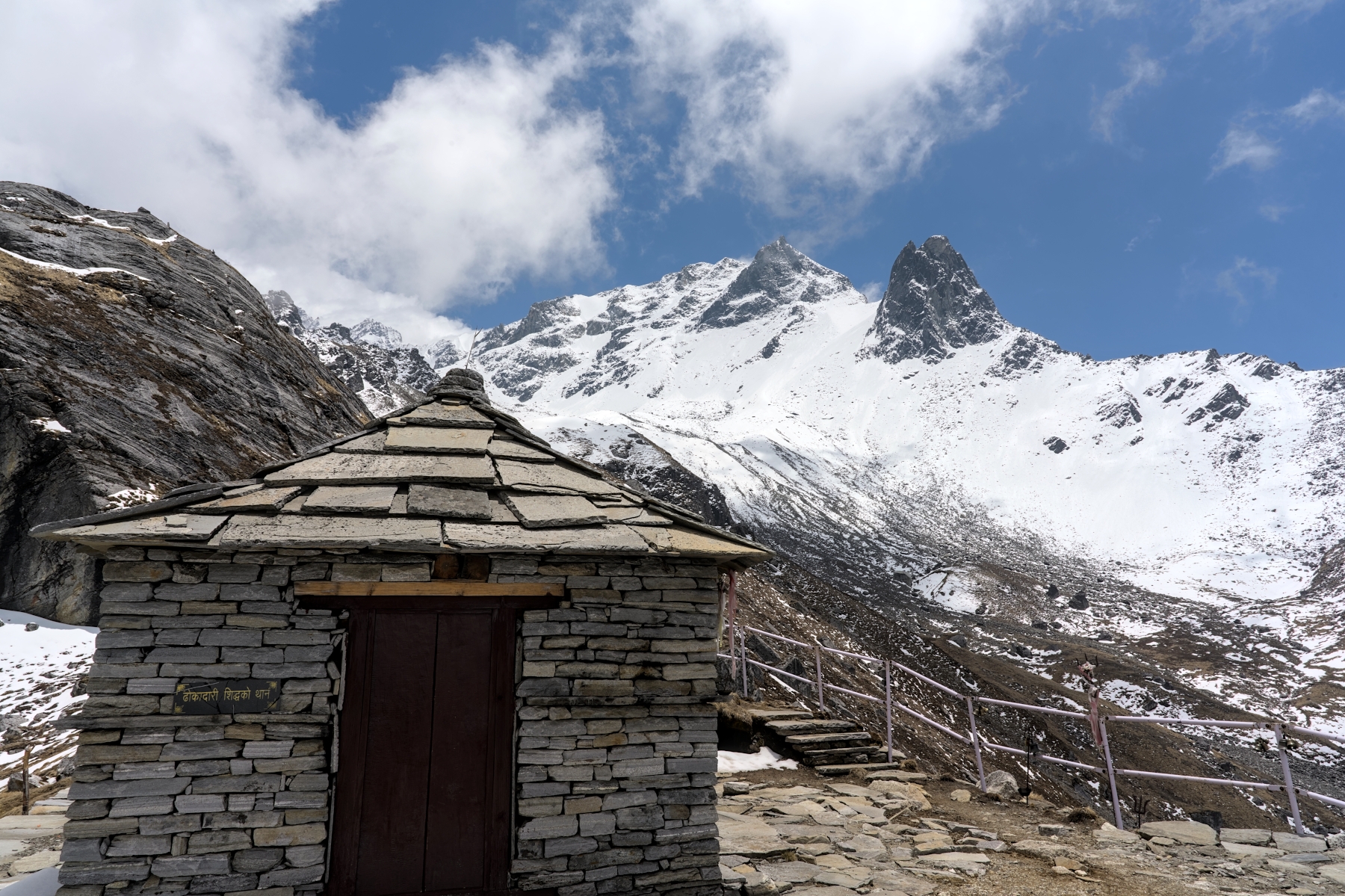
Once the trek reaches Khopra Danda, the views become nothing short of amazing. This ridge has 360-degree panoramic views, including up-close views of the Annapurna and Dhaulagiri Ranges. Here, you can view the mountains of the Annapurna Range from the southwest, an angle not seen on many other treks, and certainly not from such close range.
Sunset from Khopra Danda. Dhaulagiri (8,167 m) left, Nilgiri (7,061 m) right, and Annapurna just out of frame on right
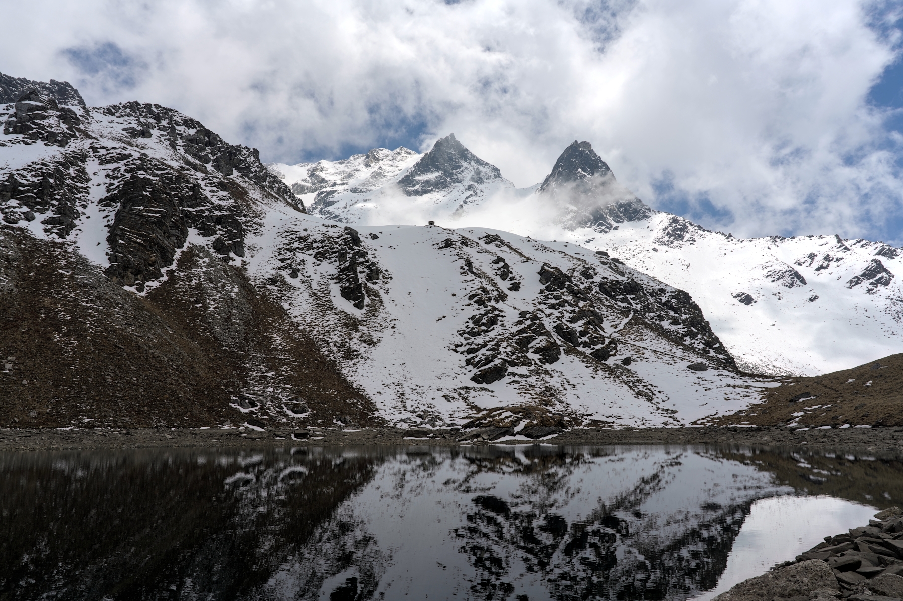
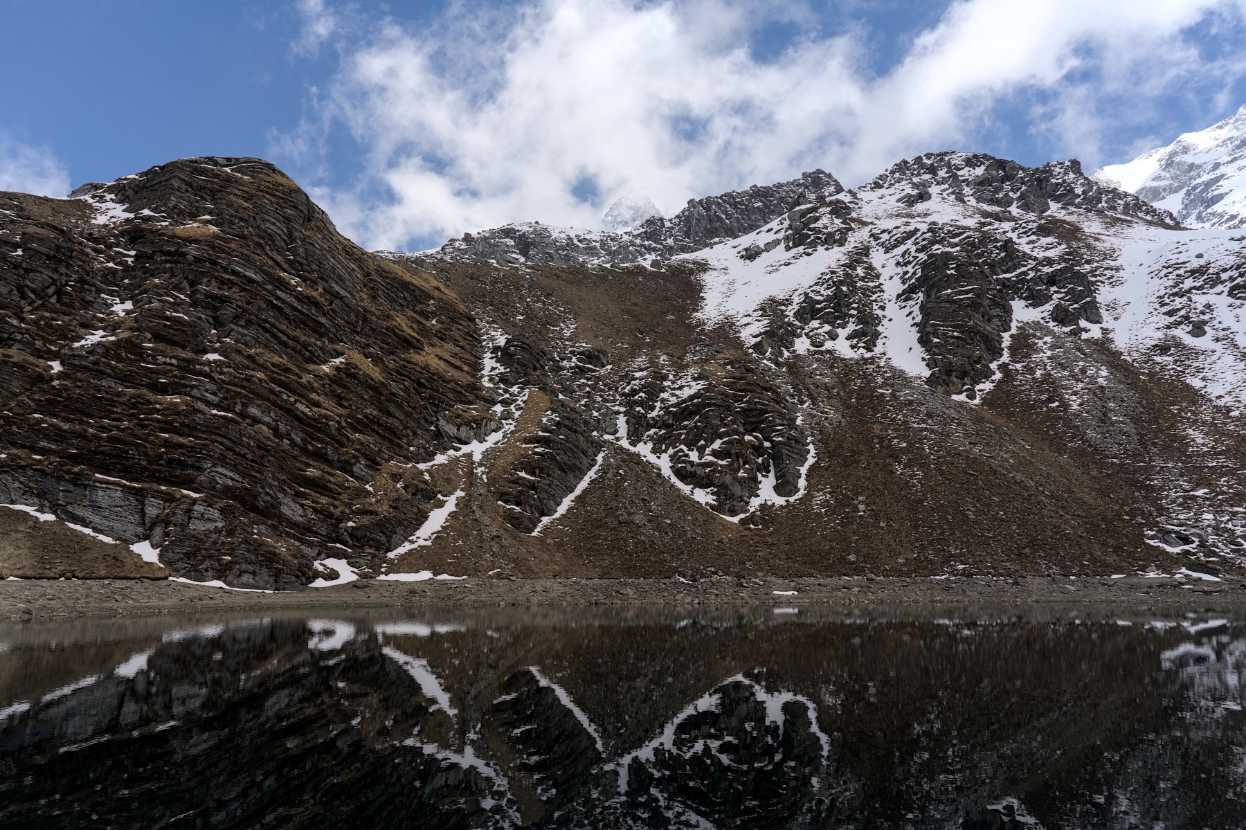
If you decide to do the Khayer Lake hike, the views get even better, with the rocky, undulating trail carving its way deep into the Annapurna Range. As the mountains get close and loom higher overhead, the views become more impressive, culminating in a beautiful lake surrounded by towering, snow-covered peaks. And these views are views that few people ever get to see, as none of the other treks in the Annapurna Region find themselves so close to the Dhaulagiri and Annapurna Massifs at the same time.
View from Khayer Lake (4,660 m), one of the most beautiful places no one has heard of
As you can see, the relatively unknown Khopra Danda Trek really punches above its weight and can stand toe-to-toe with the more popular treks in the Annapurna Region. But just as other popular treks like the Annapurna Circuit, EBC Trek, and ABC Trek were once hidden gems of the trekking world, one day word will get out about the Khopra Danda Trek. And when it does, rest assured that this trek will become more popular and commercialized, just like those treks became. If you want to experience this off-the-beaten path, hidden gem before it takes its rightful place among the more popular treks in Nepal, you’d better do so soon.
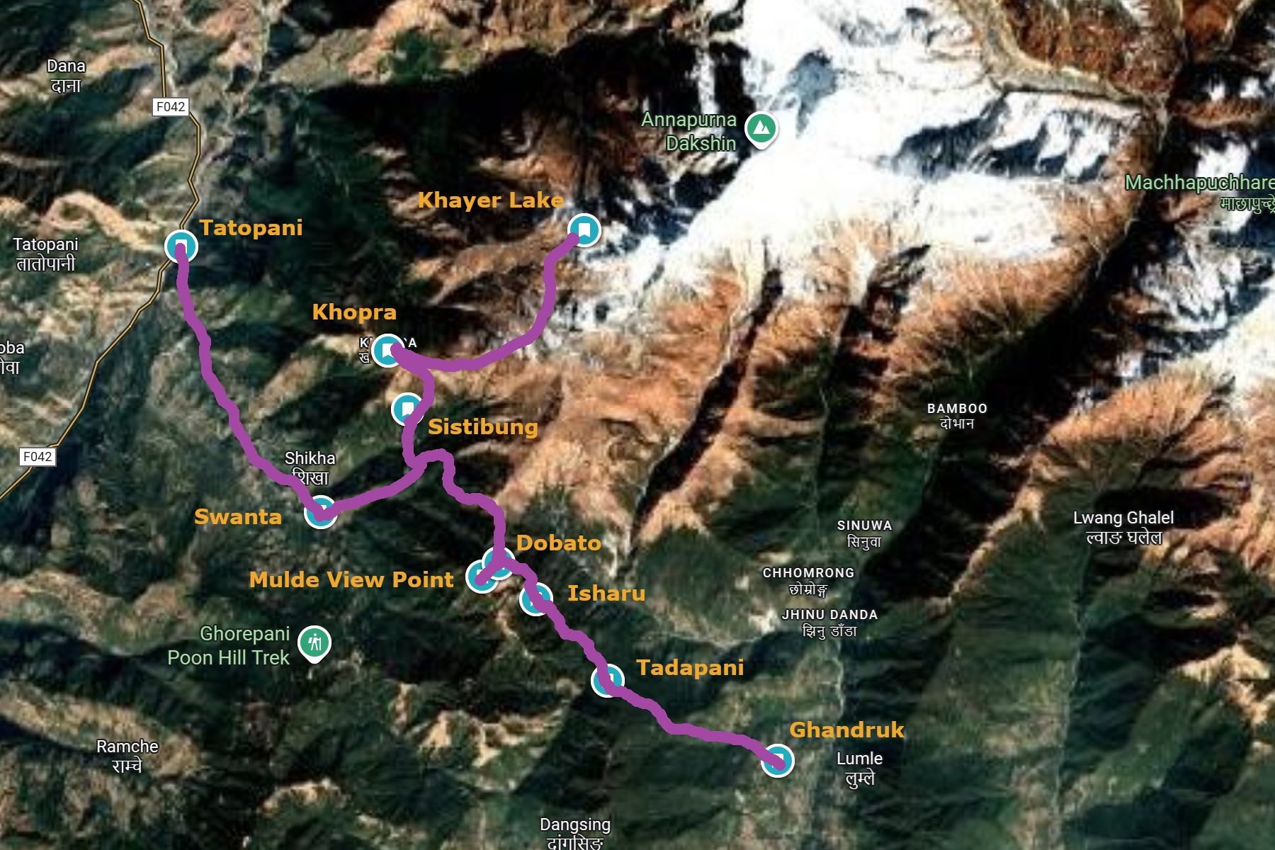
The Khopra Danda Trek is a relatively new trek in the Annapurna Region. The trek takes place on the southern side of the Annapurna Massif and culminates in Khopra Danda, a narrow ridge beneath the Annapurna Massif. Other than heading to Khopra Danda, because the trek is so new and not yet well-known, the other stops along the way vary a bit. The variations are discussed below, as well as recommendations for those having trouble deciding.
Although you might encounter other possible choices on the internet, the four most common starting points for the trek are Nayapul, Tikhedhunga, Tatopani, and Ghandruk. The merits of each starting point will be addressed below.
Nayapul is a town at the bottom of the trails leading to Tikhedhunga and Ghandruk, at an elevation of 1,070 meters. Nayapul is the first place where you must stop to show you Annapurna Conservation Area Permit to the authorities before starting your hike. If you’re looking for as much exercise and hill climbing as possible, this is a good place to start the trek. But if those things aren’t very important to you, I wouldn’t recommend starting here. The views between Nayapul and Tikhedhunga /Ghandruk are decent, but they pale in comparison to what you’ll see higher up the mountain. You can enjoy these views from the comfort of a jeep ride and save yourself many hours of hiking by driving farther up the mountain.
Tatopani is often the end point of the Khopra Danda Trek, but some treks have this as the starting point. This is another one I wouldn’t recommend, for two main reasons. The first reason is that first few days of the trek will have very pedestrian views, and you’ll be itching to see something more exciting. The second, and more important reason, is that starting here gives your body less time to properly acclimatize.
View from the trekking trail/road, about 10 minutes’ walk from Tatopani. Annapurna mostly hidden behind clouds
Tatopani is only 1,200 meters in elevation, while the next stop, Swanta, is less than 2,300 meters elevation. Most people don’t start to experience any symptoms of altitude sickness until at least 2,500 meters, so your body isn’t going to be doing much acclimatizing here. But after Swanta, the trek rapidly gains altitude, with Sistibung being around 3,000 meters elevation and Khopra topping out at 3,660 meters. That’s more than 600 meters of elevation gain on consecutive days, with the sleeping location on each night being firmly in the altitude sickness zone.
While it can be done, it is certainly risky gaining more than 1,200 meters elevation in less than 36 hours. And though you might not get altitude sickness in Khopra, if you decide to press on to Khayer Lake, at 4,660 meters, without taking at least one rest day to acclimatize, your chances of getting altitude sickness are high. I saw four trekkers make the hike all the way up to Khayer Lake, and of those four, two admitted to feeling symptoms of altitude sickness, with one of them vomiting multiple times on the hike. The Khayer Lake hike is difficult even when properly acclimatized; without proper acclimatization it can be downright dangerous. Err on the side of safety, and leave the rapid elevation change for your descent.
Tikhedhungga (or Banthani, Ulleri, or a few other villages, depending on how far you ask the jeep to drive up the mountain) is a good starting point for those who want to visit Poon Hill as part of a Khopra Danda Trek. Tikhedhungga’s elevation is approximately 1,500 meters, so you’ll save yourself over 400 meters of elevation gain and many kilometers of hiking versus Nayapul, which is reason enough to choose it over Nayapul. The hike heads from Tikhedhungga all the way up to Ghorepani, a town at approximately 2,850 meters elevation, on the first day of the trek. That’s an elevation gain of over 1,300 meters with over 10 km of hiking in a single day. The next morning you will watch sunrise from Poon Hill before hiking to Tadapani, a small settlement at a more modest elevation of 2,630 meters.
View towards Nayapul from the trekking trail, shortly before reaching Tikhedhungga
Ghandruk, on the other hand, has an elevation of approximately 2,000 meters, which is 500 meters higher than Tikhedhungga. You will be driven up the mountain road until it ends, before a modest, 100 meter or so climb to Ghandruk along paved paths, taking around 30-45 minutes. From Ghandruk, the hike will proceed directly to Tadapani where you will stop for the night. For those doing the math, by starting in Ghandruk on the first day you’ll only climb around 700 meters higher, instead of climbing over 1,300 meters if you start in Tikhedhungga. That is a big difference!
View from Ghandruk. In clear weather, Annapurna, Hiunchuli, and Machhapuchhare would be visible from here
Really, the whole choice comes down to whether or not you want to see Poon Hill. If you don’t want to see Poon Hill, then start in Ghandruk. It will make your trek shorter, easier, and less risky in terms of altitude sickness. Most Khopra Danda itineraries stop in Dobato for a night, which allows you to see sunrise from Mulde Viewpoint the next morning. Mulde is a viewpoint that is closer to the Annapurna Massif and Machhapuchhare, with fewer obstructions in the way and with a fraction of the number of people. It is a much better place to watch sunrise than Poon Hill (unless you like crowds and need a coffee bar).
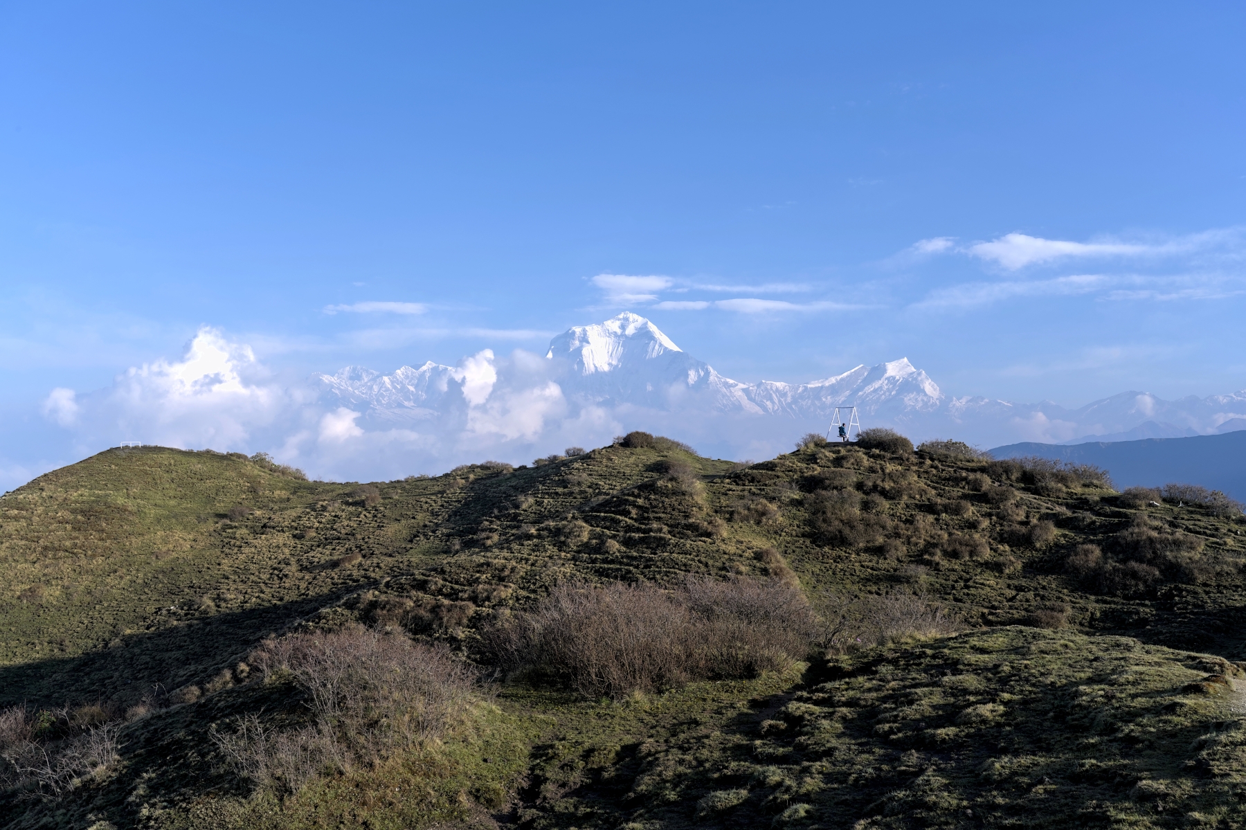
If you thought sunrise from Poon Hill was good, try seeing it from Mulde Viewpoint
That said, if you really want to see Poon Hill as well, this can easily be done when starting in Ghandruk. After reaching Khopra you will hike down to Swanta for the night, and the next morning, instead of heading down to Tatopani you can instead make the less than 600-meter climb to Ghorepani. The next day you can see sunrise from Poon Hill and then take the much easier walk DOWN to Tikhedhungga, where you can hop in a jeep and arrive in Pokhara a few hours later than you would have had you gone to Tatopani instead. For me, Ghandruk is the easy choice for a starting point on the Khopra Danda Trek.
Ignoring Khopra Danda Treks that start from Tatopani (which as discussed earlier, is not a good starting point), there are really two main ending points for this trek: Tikhedhungga and Tatopani. Treks that end in Tikhedhunga do so in order to see sunrise from Poon Hill. If seeing sunrise from Poon Hill isn’t important to you, I’d recommend ending the trek in Tatopani instead. Both treks typically include a night in Swanta, after which trekkers continue towards Tatopani or Ghorepani.
Whether you end the trek in Tatopani or Tikhedhungga, you’ll pass through the lovely village of Swanta along the way
When ending the trek on the Tikhedhungga side, you once again have options. If you are tired and/or not enjoying the views (which between Ghorepani and Tikhedhungga are admittedly mediocre) you can sometimes catch a jeep before Tikhedhungga, in places like Banthani and Ulleri. This can cut down the amount of hiking by as much as 1.5 hours on the final day of the trek. If you are having a blast and want to keep going, you can in theory hike all the way down to Nayapul on the final day, although this will be a really long trek that will take a really long time. Wherever you decide to end the hike on the road to Tikhedhungga, you will return to Pokhara via jeep.
The other, more popular ending point for the trek is Tatopani. From Swanta, you will continue walking downhill towards Tatopani, a town famous for its hot springs. Taking a dip in these hot springs is a fantastic way to relax and unwind after a long trek. From Tatopani it’s an easy jeep ride back to Pokhara the following morning.
Which ending point you choose depends on whether you want to see sunrise from Poon Hill or not. Sunrise from Mulde Viewpoint, as mentioned earlier, is a much better experience, so unless you experience bad weather on the morning you went to Mulde View, Poon Hill will be a bit superfluous. That said, sunrise from Poon Hill is an iconic view that is lovely, so you’d be forgiven for wanting to see that as well. Plus, if you see sunrise from Poon Hill, you will suddenly be able to tell which Indian Restaurants are in reality run by Nepali people, because most of those have a poster with this view somewhere in their restaurant!
Assuming the trek starts from either Tikhedhunga or Ghandruk, both routes go to Tadapani next (with Tikhedhunga having an extra day in Ghorepani prior). After Tadapani, some treks go to Bayeli Kharka, but I’d highly advise you to go to Dobato instead. This is because Dobato is home to Mulde Viewpoint, a hilltop with panoramic views of Dhaulagiri, the Annapurna Massif, and Machhapuchhare. The views at Mulde are even better than those found on the iconic Poon Hill, with far fewer people. Bayeli Kharka is also nice, and the trail there actually passes Dobato, but because it is so much closer to the Annapurna Massif, the panoramic views are blocked by the surrounding hills and mountains.
If you skip Dobato, you won’t get to see this view for sunrise. Don’t make that mistake!
After Dobato, most treks make a stop at Sistabung, but there are some that proceed directly to Khopra. While this is certainly doable (I’ve done it myself), it does increase the difficulty of the trek. The walk from Dobato to Khopra is approximately 12 kilometers, with over 600 meters of elevation loss to get down to the river and then over 800 meters of elevation gain from the river to Khopra. It is a physically demanding hike that requires pretty good fitness levels to accomplish safely. But an oft-overlooked problem with skipping Sistabung is that your body will have one less day to acclimatize before reaching Khopra. Without the rest day, you will go from Pokhara at approximately 900 meters elevation to Khopra at 3,660 meters in elevation in only 2.5 days. Doing this increases the risk of altitude sickness considerably, and if you haven’t done high altitude trekking before, I can’t in good conscience recommend it. 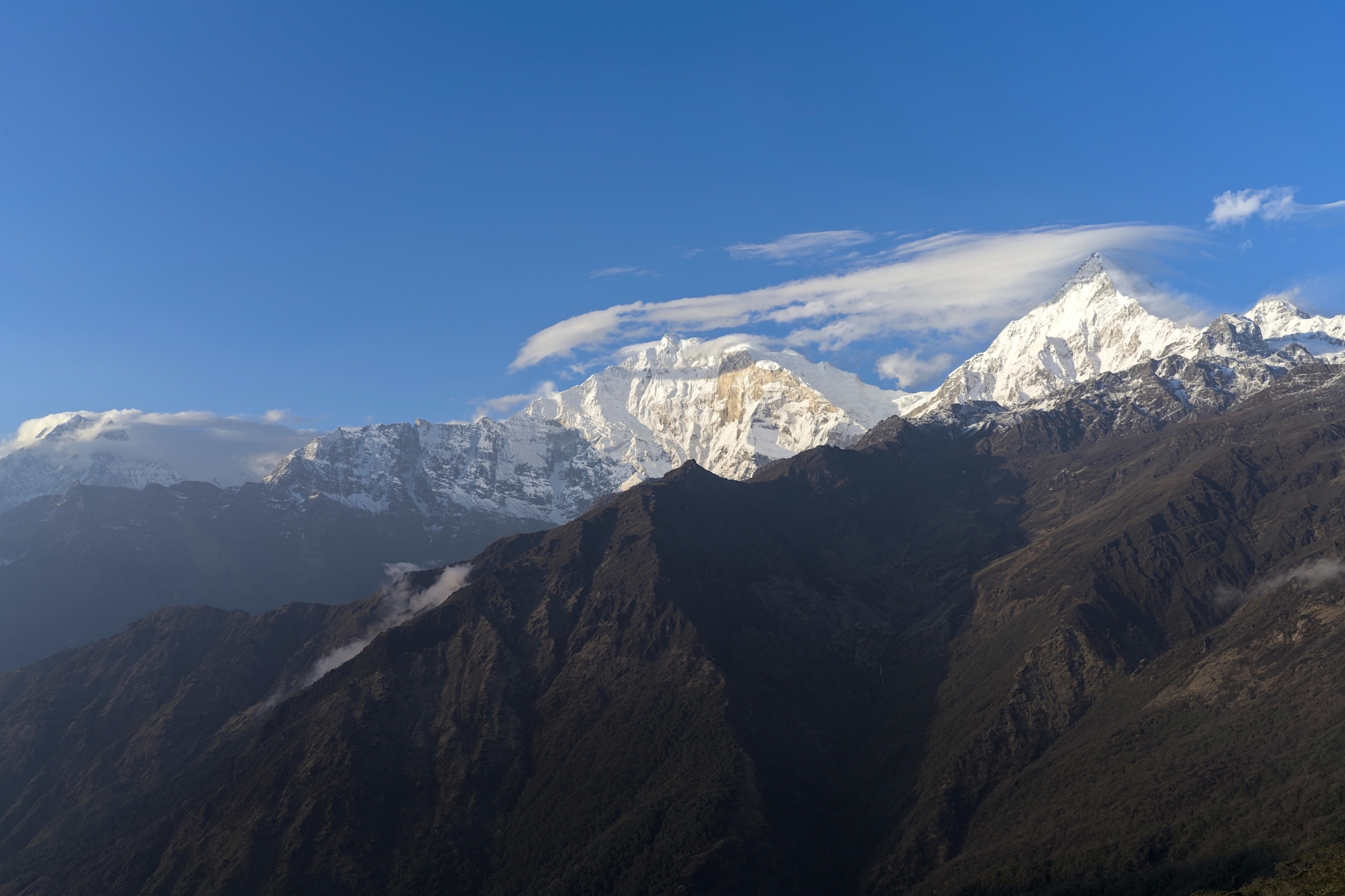
View of Nilgiri (left), Annapruna I and Fang (center) and Annapurna South (right) from Khopra
After leaving Khopra to head back down the mountain, most itineraries stop for the night in Swanta, but there are some that proceed directly to Tatopani or Ghorepani. Although I haven’t done Khopra to Tatopani in a single day, I have done Khopra to Ghorepani in a single day, so it is possible to do. Acclimatization and possibly developing altitude sickness won’t be an issue at this point in the trek, so it comes down to your individual fitness levels. The walk to Swanta is over 10 kilometers, mostly downhill, but continuing on to Ghorepani adds another 8 kilometers to the length of the trek, as well as 500 meters of elevation gain. It is a long hike and you will be tired at the end if you try to undertake it. Just know that Swanta is a lovely little village that has the most “local” feel to it on the entire trek. So, in terms of places to spend a night, it’s probably the nicest one in terms of accommodation and getting a true sense of a local community and its culture.
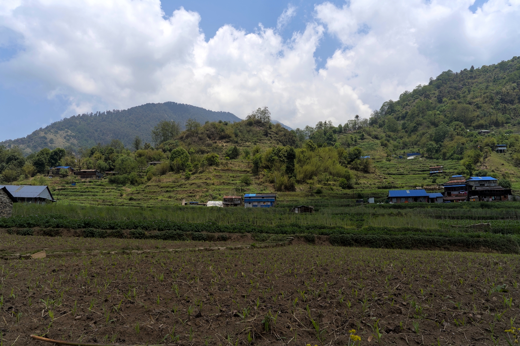
Swanta village, looking in the general direction of the Annapurna Range
For most people, the itinerary below represents the safest and most enjoyable route to follow for the Khopra Danda Trek. Isharu is merely a stop for lunch, although they do have teahouses there if you are too tired to make the push onwards to Dobato. Note that the trek to Khayer Lake is purely optional, and is not recommended for beginners.
The Khayer Lake hike is an optional day hike from Khopra and will be the highlight of the trek for those who undertake it. It is an out and back hike on some of the best hiking trails you’ll see in Nepal, the culminating in a visit to a beautiful alpine lake surrounded by mountains on all sides. There are Khopra Danda itineraries that don’t include this hike, instead heading back down to Swanta after spending the night in Khopra. These treks are one day shorter than the versions with Khayer Lake, and as a result, less expensive. If price is the deciding factor, money can be saved by skipping this hike. But assuming the cost of an extra day isn’t going to be a difference-maker, should you do this hike? The short answer is yes, you should do this hike, but only if you possess the fitness levels to do so and are feeling 100% on the morning of the hike.
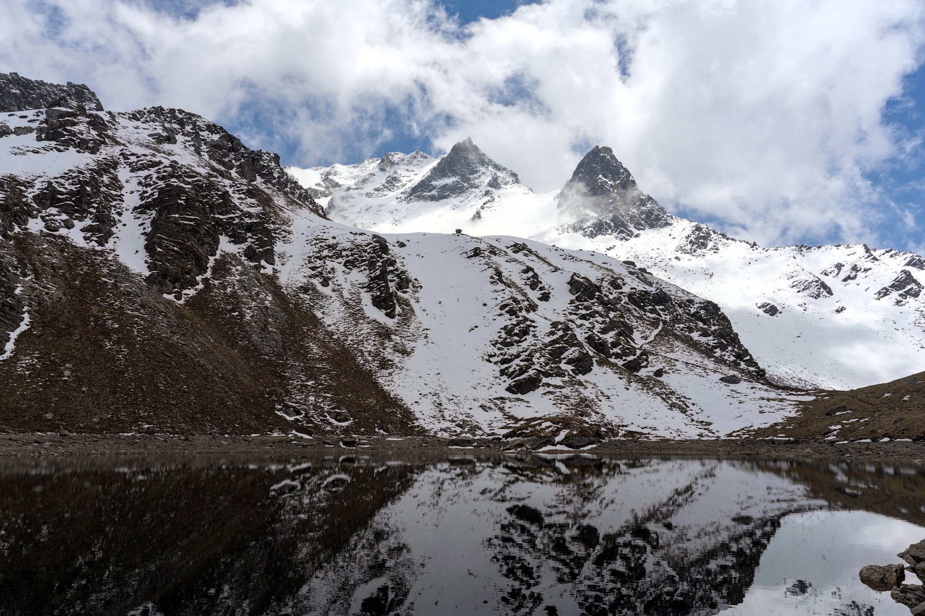
Khayer Lake is as beautiful as it is difficult to reach by hiking
Whereas the Khopra Danda Trek is an easy to intermediate difficulty hike, the hike to Khayer Lake is firmly in the difficult category of trekking. This day hike gains 1,000 meters of altitude, more than what hikers gain crossing the Thorong La Pass on the legendary Annapurna Circuit Trek, before returning to Khopra. The Annapurna Circuit is rated as a difficult trek mostly because of the Thorong La Pass day, and there is no reason why the Khayer Lake should be rated differently. While the hike over the Thorong La Pass takes longer, covers a greater distance, and the loses 600 meters more elevation on the way down than does the Khayer Lake hike, the difficulty of both treks is comparable.
In addition to sheer elevation gain, the hike to Khayer Lake is more difficult than the rest of the Khopra Danda Trek because of the terrain itself. Aside from the brief section of the hike across the Khayer River valley and a small stretch soon thereafter, there are almost no flat sections on this hike. While the trail in the first hour or so is a simple hike up a ridge on hardpack dirt, the remainder of the hike is on raw, rocky, undulating terrain that is always exposed. There are no trees or bushes to block the strong winds and possible bad weather; it’s just you and the mountain. And the staircase after the Khayer River (more on that later) is the stuff of nightmares. Don’t get me wrong, the trail to Khayer Lake was one of the most enjoyable hiking trails I’ve ever been on (besides the stairs, they were awful), but it isn’t enjoyable in the sense of a fun little walk in the park. It is enjoyable because of how raw, rugged, and challenging the trail was, especially considering the sheer beauty all around it.
View from near the top of the final climb of the hike. Khayer Lake is behind the snowless mountain on far left
The second, and arguably more important factor that makes the Khayer Lake hike so difficult, is the altitude. The altitude of Khayer Lake, at 4,660 meters, is a full 1,000 meters higher than Khopra. I know some people might look at the altitude and think 4,660 meters isn’t so bad; it’s 700 meters lower than Everest Base Camp and 750 meters lower than the Thorong La Pass on the Annapurna Circuit. But make no mistake, 4,660 meters is well within the altitude sickness zone, and unlike the EBC and Annapurna Circuit Treks, this trek doesn’t leave much time for acclimatization.
Whereas the Annpurna Circuit has an acclimatization day at 3,500+ meters and the EBC Trek has two acclimatization days at 3,400 and 4,400 meters, respectively, on the Khopra Danda Trek there are no rest days. You’ve probably heard the rule that for every 600 meters in elevation gain, you should take an acclimatization day; but after the rising 800 meters between Tadapani to Dobato there isn’t a rest day the, there’s a full-blown hike to Sistabung. The hike from Sistabung to Khopra rises another 600+ meters, but again, the standard itinerary does not include an acclimatization day here. Still, the trek to Khopra is safe enough where the vast majority of people won’t experience altitude sickness (though you’re pushing your luck if you skip the night in Sistabung and go straight to Khopra).
But if you don’t take a rest day in Khopra before trying the Khayer Lake hike, you are taking a big risk in terms of altitude sickness. At this point, although you might not feel it, your body is trying to cope with the thin, low-oxygen air around you. Going up another 1,000 meters without fully acclimatizing to the altitude will push your body to the limits. Of the four other people who hiked all the way to Khayer Lake on the day I did it, two of them admitted to having symptoms of altitude sickness, with one having serious and concerning symptoms.
Trekking trail a half hour from the Khayer River. Although it looks easy, the elevation here is around 4,000 meters
Unlike hiking long distances, spending lots of time going uphill, and navigating difficult terrain, there is no way to prepare for or predict altitude sickness. I’ve seen incredibly fit, young people being carried down the mountain and rescued by helicopter at less than 5,000 meters altitude. I’ve seen older, overweight, out of shape-looking people hiking at over 5,000 meters and looking like they’re enjoying a leisurely stroll at sea level. A person’s ability to acclimatize to and operate at high altitudes is completely unpredictable, and unfortunately, the only way to find out is to try hiking at high altitudes for the first time.
For this reason, if you haven’t hiked at high altitude before, I wouldn’t try to undertake this hike without spending an extra day in Khopra to acclimatize. With an extra day of acclimatization, the risks of altitude sickness decrease significantly. And, of course, if you have a headache, are short of breath, don’t have an appetite, or feel nauseous, it is best to skip the Khayer Lake hike and head down to Swanta. But if you are fit enough, feeling good, and can handle high altitudes, I’d say give the Khayer Lake hike a go.
Starting early in the morning (before 8AM is highly recommended), the first hour or so follows a grassy ridge uphill, along hardpack dirt yak trails. This is the easiest section of the hike, but it is steadily uphill nonetheless. Once the ridge joins with the mountains and hills above, the trail becomes rocky and undulates considerably, going up and down (but mostly up) for another two hours or so until reaching the Khayer River. If you make it to the Khayer River in less three hours, you’ve set a fast pace.
Trekking trail about halfway between Khopra and the Khayer River. It’s a lovely trail here, but it gets harder soon
The alpine valley with the Khayer River running through it is flat and pretty easy going. Once across the valley, the trail turns to the left and passes a small teahouse where you’ll eat a lunch on the way back down the mountain. After weaving through the small hills, there will be another flat section that hugs the side of a mountain for around 10 minutes before reaching a stone staircase. If you thought the hike was difficult leading up to this point that’s a problem, because unfortunately it’s about to get a lot more difficult.
This stone staircase rises over 400 meters, straight up the mountain, without stopping. It’s like climbing from the ground floor to the top of the Empire State Building, and then continuing to climb for another 50 meters or so. And instead of from sea level like the Empire State Building, this climb will begin at over 4,000 meters altitude, after hiking more than 3 hours to get here. I won’t sugar coat it, there is nothing fun about this section of the hike; it is absolutely brutal. The steps in this section are shockingly well-constructed and easy to navigate as far as steps on a hiking trail go, but this section of the climb will still have you regularly questioning your sanity.
After what seems like an eternity, the stairs mercifully end and the trail becomes loose dirt and rock, heading up a hill that eventually flattens out and reveals a deep valley surrounded by mountains. After finally making it to a flat section after all those stairs, you might do as I did and scan the valley, looking for a lake. There might be some small streams there (depending on the time of the year), but unfortunately, there will be no lake to be found here. Then, looking to your left, you’ll see another flight of stairs heading up a ridge and realize that you still have some climbing to do. It’s tough not to feel a bit detected here and want to give up, but trust me you’re almost there.
Khayer Bharani Temple. After this, it’s an easy, 10 minute walk to Khayer Lake
After navigating this final hill section, the trail reaches a small temple called Khayer Bharani Temple. It’s a small, basic temple, but it is surrounded by incredible views. Here you can thank the gods, because the hard part of the trek is over, and you’re only about 10 minutes from Khayer Lake. From this temple, the trek to Khayer Lake is easy; a gentle climb along a rocky trail along the ridge, then turning left and walking a hundred meters or so, you’ll finally be able to see Khayer Lake. All told, the hike to Khayer Lake can take anywhere from 4.5 hours to 6 or more hours, depending on your hiking speed and fitness levels.
Khayer Lake in good weather, with the water calm and reflective. Annapurna South behind, poking through clouds
Khayer Lake is quite small; it can be circumambulated in less than 15 minutes. And I’d recommend doing so, because there are different views in every direction. It shouldn’t take more than 20 minutes to see everything and take all the photos you want if the weather is good. If it’s cloudy or misty when you go, I’d recommend waiting an extra 10 minutes before leaving just in case, because the weather here changes fast! When I was there it went from cloudy, to almost completely clear, back to cloudy again in a 20-minute span. I’m not saying that will be the case if you come here, but the weather here is quite unpredictable, so it’s possible.
Once you’ve had your fill of Khayer Lake, the hike back to Khopra follows the same trail back down the mountain. I’d recommend stopping at the little teahouse near the Khayer River, as by now you will surely be hungry and by the time you get there it’s still a minimum two hours until reaching Khopra. Side note, this little teahouse / restaurant had great veg pakoda considering how remote the place was. For me, it took about 2.5 hours getting down from Khayer Lake, but normally it should take considerably longer. We were rushing for the last hour and a half because there was a storm moving in that looked intense. But the same terrain that tested you on the way up will be a joy on the way down. It really is an awesome little track to hike.
All told, it took about 7 hours and 45 minutes for me to do the hike (including a quick lunch), but the girl who left 5 minutes after us in the morning arrived 2.5 hours later than we did in the afternoon. The other group of three trekkers I saw on the trail that day told me later than evening in Khopra that the hike took them more than 11 hours to complete. Times will vary considerably due to the length and elevation gain of this hike, but I would say it should generally take between 8 and 11 hours.
How Can You Reach Everest Base Camp?
Tailor-made trekking packages by agencies are tough to find in the context of Nepal. Having said that Roving Nepal Trek stands out from the rest and provides tailor-made packages for all of its clients.
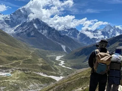
If you are planning to go trek to Everest Base Camp, this thorough set of Everest Base Camp Trek FAQs answers your every question.
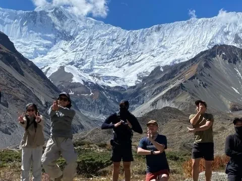
Do you know that the Annapurna Circuit Trek in Nepal is the most commercial and the oldest trekking route of Nepal? Yes, the trail of the Annapurna Circuit Trek has been the cornerstone of Nepalese trekking industry. Therefore, the interest in this route is very high among trekkers from across the globe. People yearn to knit momentous travel moments in the valleys like Manang and Mustang with the iconic Thorong La Pass (5416 m). So, the Roving Nepal Trek decided to provide authentic information about the trek. The blog titled “How to prepare for the Annapurna Circuit Trek in Nepal?” can be useful for you to plan or budget for the trek.
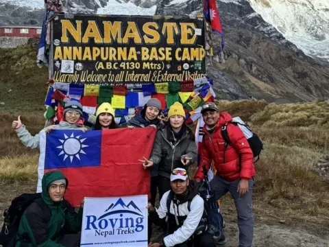
One of the darling trekking destination of the world is the Annapurna Base Camp Trek. Therefore, the charm of this route is very high among travelers from across the globe. The journey that takes trekkers to the foothill of the world's 10th tallest mountain is definitely a prized one. There are lots of questions about the Annapurna Base Camp Trek for Beginners. So, today's blog is all about finding out reasons that make the ABC Trek suitable for all age group from beginners to professional trekkers.
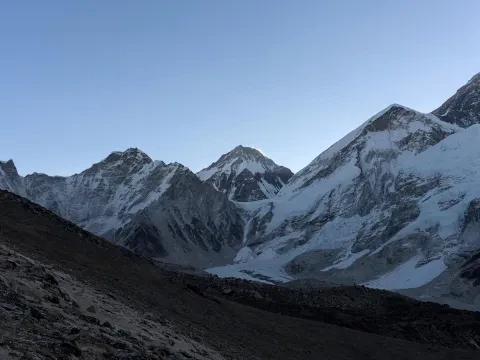
If Everest is known as the "King of the Mountains," should the EBC Trek be known as the "King of the Treks?" This blog explains why maybe it should be